The Iditarod Trail Invitational is coming up at the end of February. With options of 130 miles to Finger Lake, 350 miles to McGrath, or 1000 miles to Nome.
I was lucky enough to ride to McGrath the past three years. Since im not racing it this year, I thought I’d write up a little reference material for watching the blue dots on trackleaders.com.
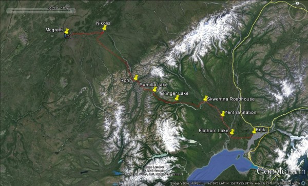
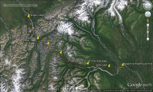
The 350 miles to Mcgrath has 6 checkpoints spaced out between three distinct geographic regions. The approach to the mountains, the climb and decent through the Alaska Range, and the cold, remote interior region.
Knik to Skwentna
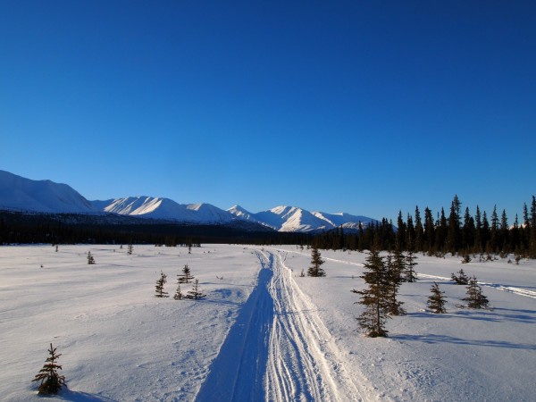
The first 90 miles approaching the mountains are mainly flat river riding. It’s a good long warm up for the rest of the race. It always seems like this is a very social part of the trail, a great chance to catch up with friends and meet new riders that have a similar pace in mind.
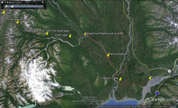
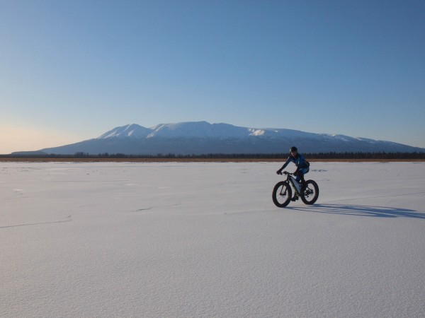
From Knik Lake Just outside of Wasilla, racer leave through a mix of trails, powerlines and roads out to the pipeline trail that leads in a straight line with Flathorn Lake 30 miles into the race and a great view of “The Sleeping Lady”.
The trail traverses several more swamps, and then drops onto the Susitna River about 45 miles from where the race began. Riders will turn North, up river, with views of Denali and Mount Foraker on a clear day.
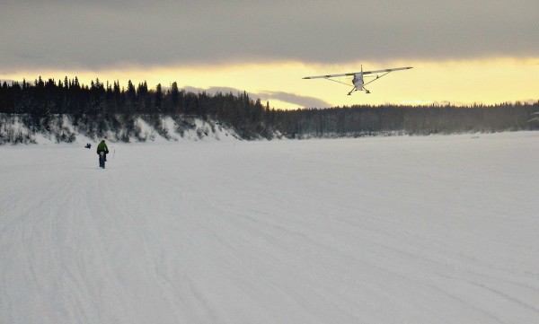
Just a few miles up the Susitna, the trail will head West at the confluence of the Yentna River. This river drains much of the Western Alaska Range. It’s well travelled, with a lot of freight traffic, snow machines, dog teams, prop planes, and remote properties.
Although the river is often dependable, it can be plagued with a persistent cold headwind pouring out of the mountains to the north and west. Overnight temperatures can drop along stretches of the river if the winds let up. I’ve heard of more than one story of unexpected -40 temps along this stretch.
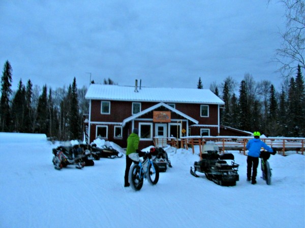
60 miles into the race is first checkpoint, Yentna Station. Established in 1982, it’s a functioning good old fashion roadhouse. A place to get a meal, a drink and a room to sleep far from the highway. The Iditarod trail is busier than many paved roads in Alaska for the first 160 miles, making it uniquely suited to economically support these great respites from the trail. Most items on the menu are 15 dollars, making decisions and budgeting easy. Plus it’s rumored to have the best Burgers on the River.
The trail continues 30 miles upriver, to the confluence of the Skwentna River. The trail splits and there’s two options to get to the Skwentna Roadhouse, the second checkpoint. One of those options is a mile or so longer than the other, chose wisely.
Here at the Skwentna Roadhouse things start to change and take shape. Since the ITI doesn’t start until 2pm, riders are often arriving at Skwentna in the middle of the night tired, and hungry. The comfort of a Checkpoint can be difficult to escape.
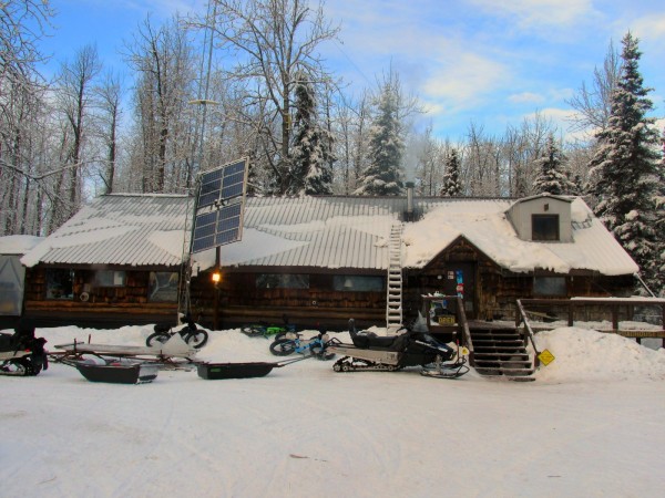
Skwentna Roadhouse is one of the best spots on the trail. The Menu of food is huge and delicous. Cindi will cook you up anything you want at any time of day. There’s a large woodstove in the living room with a rack of moose antlers to hang wet gear.
If things are going wrong for a racer, Skwentna is the least expensive place to drop out. There’s flights to Anchorage daily. The next place with this much convenience is McGrath. So you if you go past Skwentna, you might as well finish the race.
Skwentna to Rohn. Mile 90 to mile 200.
This Next 110 miles of trail, is the heart of the race, steadily climbing up through the mountains and Rainy Pass, then down through the Dalzell Gorge.
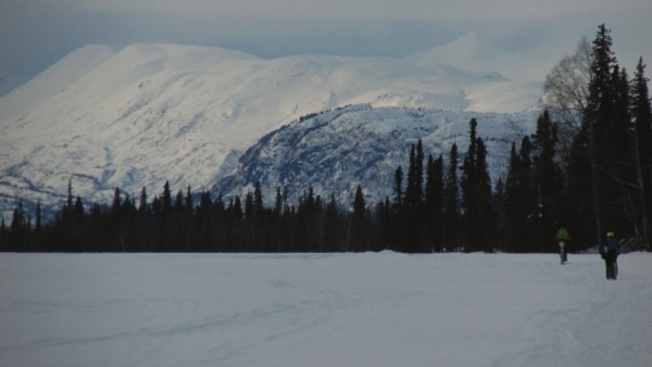
The trail leaves the rivers and enters the foothills of the Alaska Range. It dodges through the Shell Lake Hills.
Small stunted black spruce trees of the swamps are replaced by old twisted gnarled Birch trees, tall and straight White spruce, and a tangled web of bent over Alders. The elevation is only between 400-600 feet, but the snow gets noticeably deeper here.
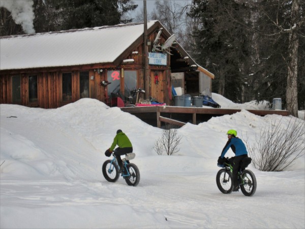
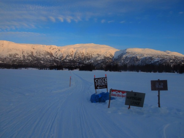
It’s a welcome change of pace. After rolling through the hills for a while, riders drop down to Shell Lake, and cut diagonally across the ice to Shell Lake Lodge, another roadhouse along the trail. This is not an official checkpoint, but a great stop for a hot meal or cabin to get some sleep.
The trail exits the back of the lodge up a steep hill until it opens up into another series of swamps. It continues overland just off the Skwentna River for 20 miles or so to Finger Lake.
The third checkpoint is at a 5 star remote lodge called, Winter Lake Lodge, situated on Finger Lake. The Dixon Family operates this very upscale establishment 130 miles up the Trail. The stinky and delirious racers are not allowed in the main dining area, but one free meal is made for every weary soul that walks in the back entrance of the Kitchen.
Finger Lake is also the location of the first 10 lb. drop bag that’s sent out in advance of the race. Rohn, on the far side of Rainy Pass, has the second drop bag. There’s some basic rules. They can contain food, batteries, beer, or handwarmers, essentially disposable items. Hard goods such as jackets, socks, goggles, or electric motors are prohibited by race rules.
Climbing towards Puntilla Lake
The next 30 miles climb up the Happy River valley. The Happy River Steps, a series of very steep switchbacks that lead down to the confluence of the Happy and the Skwentna rivers, are notoriously difficult to negotiate with a sled dog team, but with the right conditions on a bike it can just be a lot of fun.
After crossing the Happy River, the trail then ascends an extremely steep gully to get back up above the valley bottom. It is one of the steepest pushes I’ve encountered on any trail. Steep enough that you worry you’ll lose footing and send your bike tumbling several hundred feet back down to the ice below.
The trail starts to peak above tree line. Offering huge panoramas of the surrounding terrain, it’s a very fun and beautiful stretch of trail that eventually drops onto Puntilla Lake, home to Rainy Pass Lodge the fourth checkpoint, and the base of a huge broad alpine valley called Ptarmigan pass.
Puntilla Lake, about 160 mile in, is the halfway point of the race. Time to gather yourself for the climb over Rainy Pass to Rohn on the other side of the mountains. The Next 30 miles have taken the race leaders anywhere from 6 hours to 36 hours depending on weather conditions.
Just like Winter Lake Lodge, Rainy Pass lodge is a pretty swank establishment, the ITI racers are allowed to use an old cabin that is sinking into the ground on the edge of the lake. The barrel stove in the corner has a 5 gallon pot of water keeping dozens of cans of soup warm and ready. Some varieties of soup sit with my stomach better than others.
The trail climbs pretty steeply off of the lake into Ptarmigan pass. It’s a huge U-shaped valley far above treeline, miles across that curls West. The forth valley that dives down from the north is Rainy pass.
Crossing back and forth over a creek, it’s a steady climb up to a small lake just shy of the pass. Several hundred more feet of climbing and the views change. The North side of the mountains come into view, as racers crest the pass at about 5500 feet.
The mountains on the North side of the pass are rockier and drier. The trail descends through a tight creek valley with snow loaded hillsides above. If the trails are fast, it’s a fun and a bit of a technical decent. For miles of downhill riding, snow quickly disappears, due to the rain shadow effect, while the trail bashes through brush, crosses the Dalzell creek, and dives into the infamous Dalzell Gorge.
The gorge is a tight narrow canyon. The creek is always flowing with lots of open holes, big boulders, and broken ice shelves.
A couple miles later the canyon dumps into the Kuskokwim River, not far from the most remote checkpoint of the Race, Rohn.
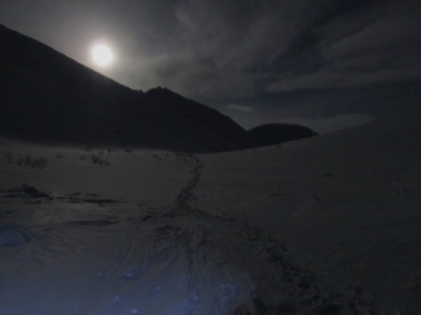
The river ice is often clear, black and glare, with sheer rock walls blocking any chance for the trail to be on more stable terrain. This little section is pretty intimidating. The wind can be howling, If its night, the clear ice soaks up all the light from your headlamp, It seems like a place to leave quickly.
Rohn is tucked into some of the spruce trees on the far side of the river. The snow that may have been five feet deep back at Puntilla lake is now replaced by dirt and moss. Rohn is a public use cabin and an airstrip 200ish miles from the road. This is also the location of the second drop bag that racers sent out weeks in advance.
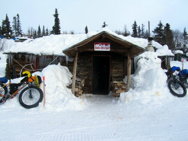
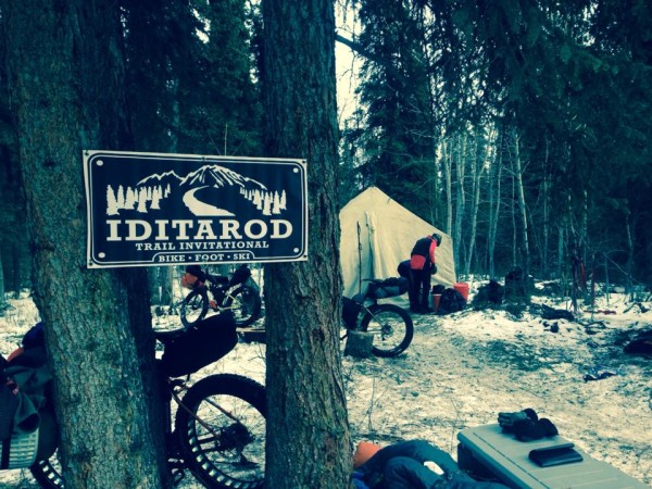
The trail crew for the Iditarod sled dog race is typically using the cabin, so here, racers are left with a wall tent and a bed of spruce bows as a checkpoint.
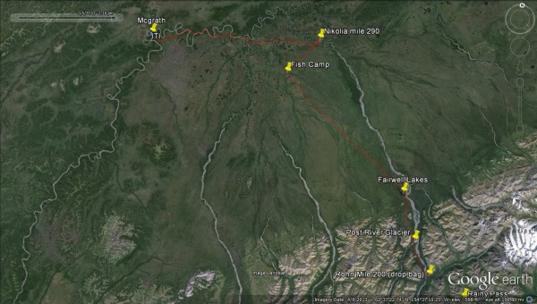
Rohn to the finish in Mcgrath mile 200 to mile 330.
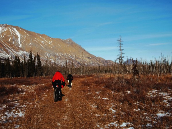
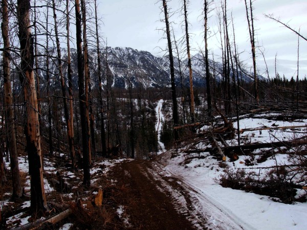
The race to the finish starts here. Its difficult to make a move on a field of good racers before the mountains. But now the wind usually blasts from up valley, hurrying riders away from the mountains, through the Farewell burn, past herds of buffalo and the wolves that are always chasing them into the vast interior of Alaska.
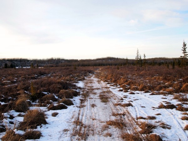
The rainshadow usually leaves about 20-40 miles of trail with scant to no snow. In 2015, 60 miles were bare, leaving the trail a mess of tussocks, old lath, busted snowmachine parts and broken trail reflectors.
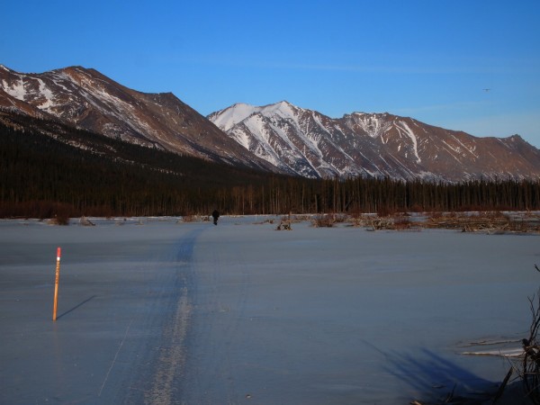
As the valley walls open up, the trail crosses a lot of overflow ice and the famous Post River Glacier. Its not actually a glacier, but a huge flow of ice that pours down over a rock formation, it’s very dynamic and it’s always changing.
From Rohn to Nikolia, the next checkpoint, a small village along the Kuskokwim, it’s about 70 very remote miles. It’s mostly flat and cold, with two opportunities to refresh your water supply. About 50 miles past Rohn is the Bear Creek public use cabin. Depending on weather, the Bear Creek Cabin can feel like a life saver.
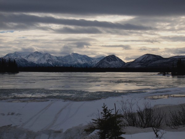
I think a lot of people expect the challenge of the mountains. But the interior of Alaska can play games with your head, it’s unchanging scenery can be demoralizing and disorienting. It’s extremely cold on average and the trail doesn’t have nearly as much traffic. After miles of riding through swamps, lakes, and sloughs, the trail drops onto the Kuskokwim River near Nikolia, the last checkpoint of the race.
Slowly the village comes into sight. Roads, a school, airport, and a church, Nikolia is the first true village off the road. It feels far removed from the south side of the Alaska Range, with the deep snow, epic mountains, and luxurious roadhouses.
The Checkpoint, which can be tricky to find if the village kids decide to take down the lath that help racers find the home of the Petruska family.
They’re always ready to serve up a big plate of spaghetti with a side of bread and coke. The Petruska’s are extremely kind and open their home to racers that trickle into their house at all hours of the day for up to week.
From Nikolia, on a full stomach of pasta and coke. it’s the final stretch to the finish in McGrath. The trail heads down the Kuskokwim River for 50 miles. Chances are that racers are starting to lose it mentally, everything really looks the same. Its hard to determine where you are.
Fish camps and cabins start to dot the river’s edge and about 10 miles from the finish the trail heads overland to a gravel road on the outskirts of town. It’s an awesome feeling to hit the road, it’s the beginning of the end. Several miles later, the road makes a bend and the Iditarod Trail Invitational banner comes into view hanging outside Peter and Tracy Schneiderheinze’s house.
Inside you’ll find a lot of satisfied, happy racers and an endless amount of food prepared by Peter. There’s no prize money or awards for finishing the race, just a day or two of rest, waiting for a flight back to Anchorage. Spending it in the company of other racers, exchanging stories on the trail, eating too much food, and sleeping often is a unique time that can only be experience by having the right combination of stubbornness and patience it takes to finish.

Excellent trail guide, thanks for sharing Kevin. The pics and descriptions put you right on the trail.
Great write-up, Kevin. Just one minor correction: the elevation at the top of Rainey Pass is about 3,450 feet, not 5500.
What a great article! It really brings the trail to life. Thank you Kevin for sharing.
Please everyone read the BLM Environmental Impact Statement on the proposed Donlin Gold Gas Pipeline that would build dozens of airstrips, gravel pits and access roads and pipeline check stations (buildings) along the most remote parts of the Iditarod Trail.