The Idaho Hot Springs Route
The Idaho Hot Springs Mountain Bike Route, by Adventure Cycling, is a 517 mile main route, with several single track options. Months ago, we decided we wanted to tackle the main route in whole this summer. We picked two weeks in June after school ended and decided we would start in the Sun Valley area, as Ketchum was closest place on the route, to where we live, in Victor, ID. June 16th we began our grand Idaho adventure. Taking on more distance or climbing in a two week period than we ever had before, fat and loaded, with April our 20-month old daughter in tow.
We started our ride 12 miles south of Ketchum in Hailey, ID. We parked our car at a friend’s place there. The forest service has limits on overnight parking and there is a lack of long term parking options in Ketchum. Parking in Hailey was our best option. From Ketchum we planned on following the course clockwise to Featherville, Idaho City, McCall, Stanley, and then back to Ketchum. Many of the towns along the route were quite small. We planned on resupplying our staples such as diapers, fuel, and dinners, in Idaho City, McCall, and Stanley, with smaller resupplies of snacks, where there were convenience stores.
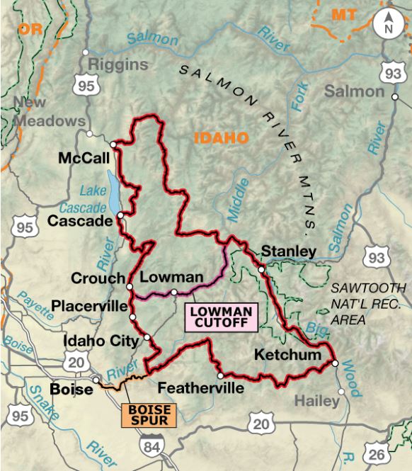
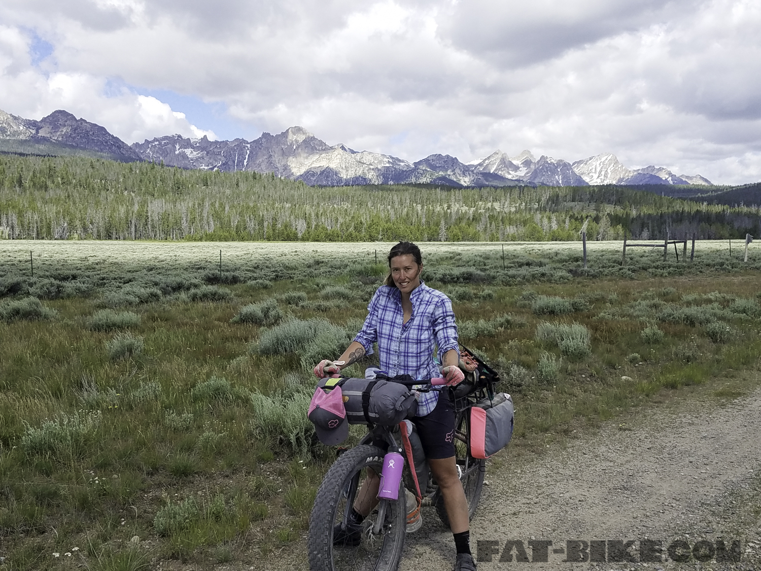
Ready to start our ride.
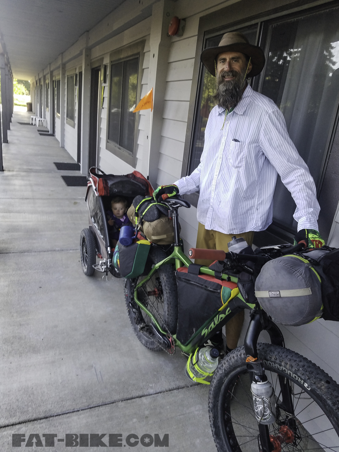
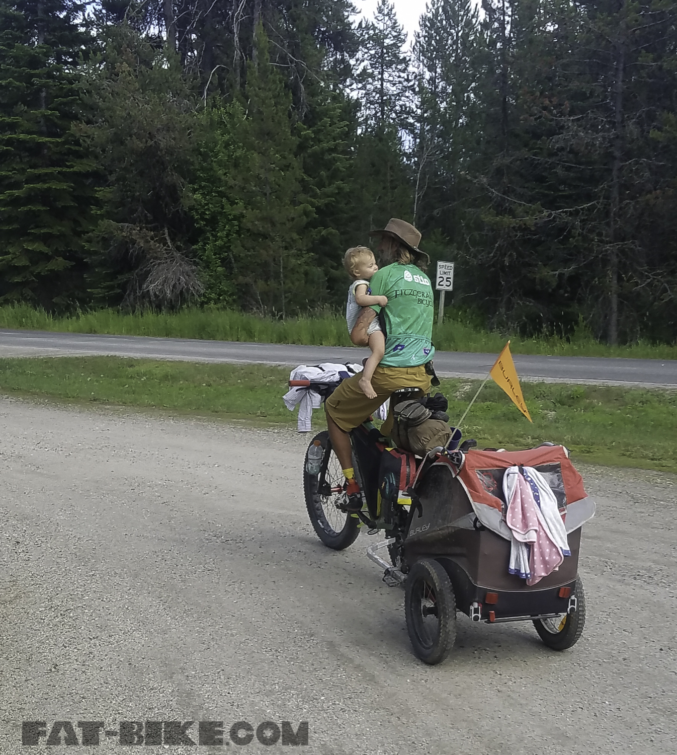
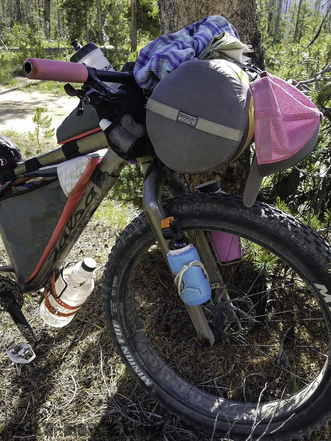
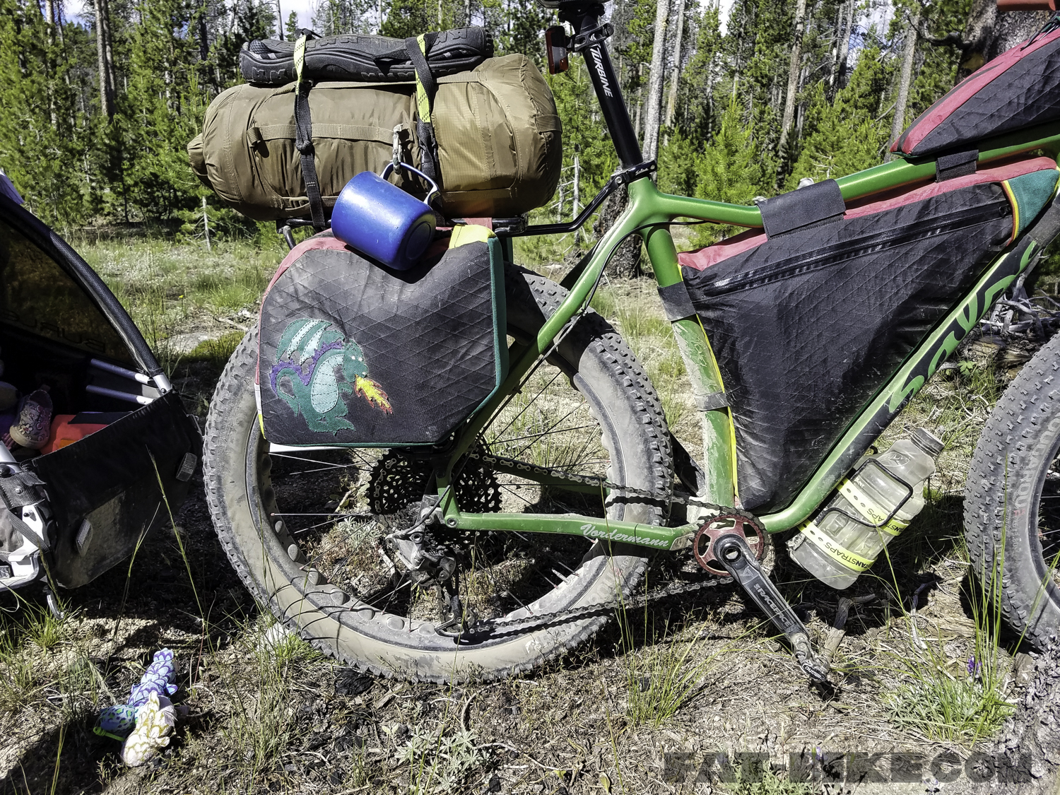
We intended to ride the full route, in 15 days, that included one day for rest in McCall. McCall was just over half way through the route. For this ride Bryon rode his Salsa Mukluk. Bryon makes bike bags, for our small business FBJ Creations. He had a custom set of mini-panniers, a frame bag, and fuel tank on his bike, along with 2 dry compression bags from Outdoor Research, and 2 Revelate Designs Mountain Feedbags, to carry his food and gear for this trip.

Bryon’s bike, Puff Muk, Fat and Loaded.
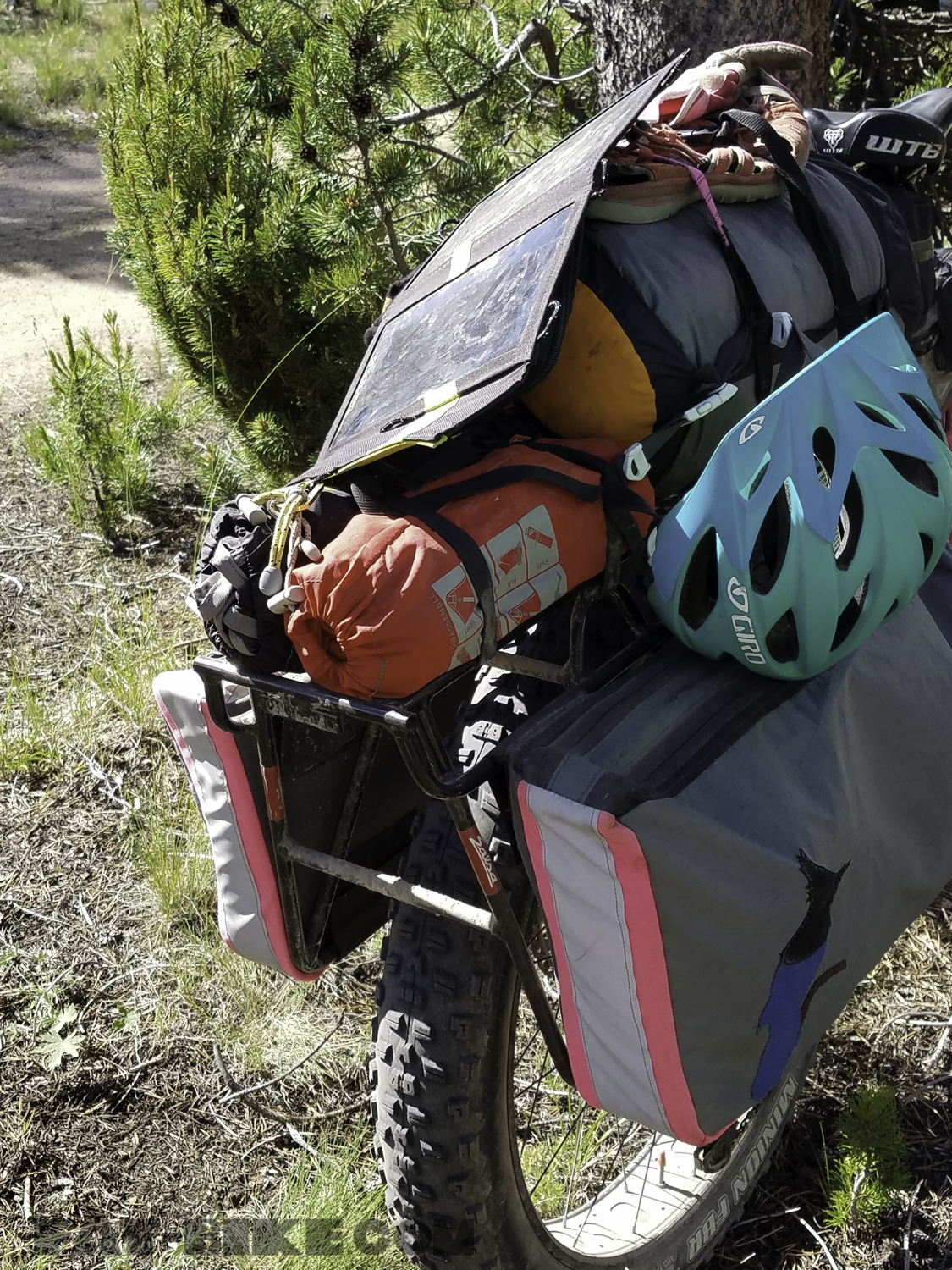
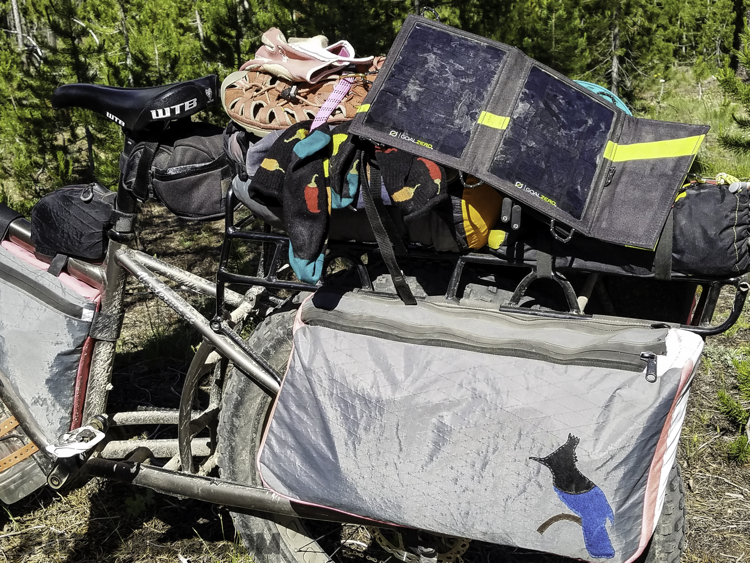
Becky rode her 2018 Salsa Blackborow for this trip. FBJ made her custom “suitcases” for the rack, a frame bag, and a fuel tank to carry her gear. Becky also carried two dry compression sacks, two Revelate Mountain Feedbags, a Revelate Designs jerrycan, and a small seat bag for tools and a tube, on her bike.
Bomber Betty
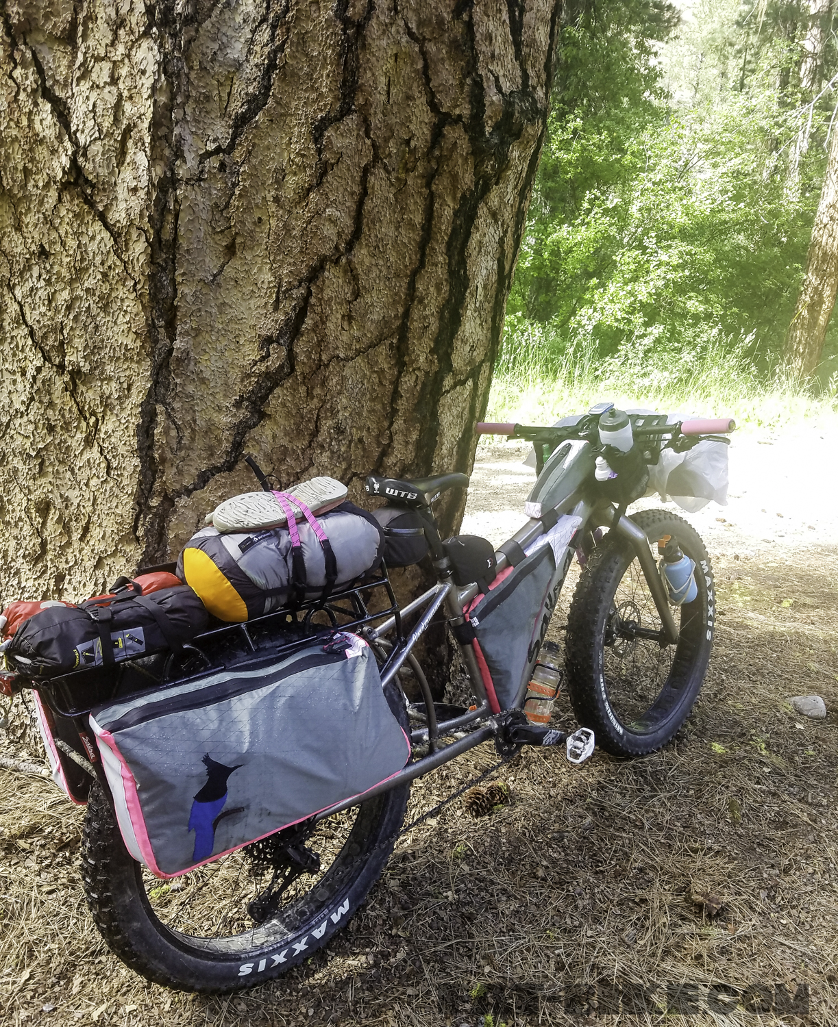
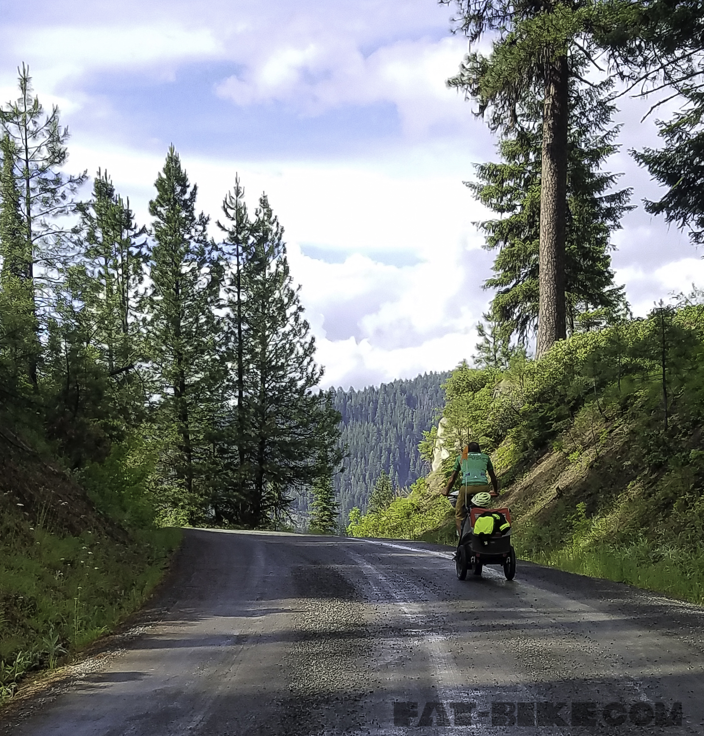
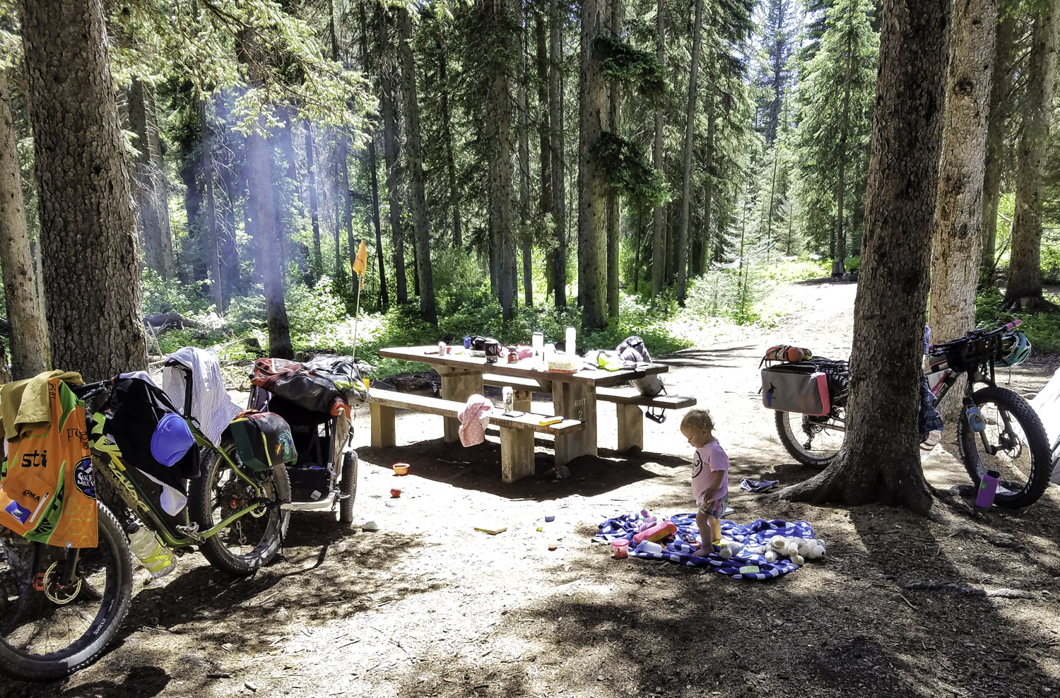
April and her toys travelled along, in the Burley Solo trailer. We ran Burley’s plus wheel set on the Solo for this trip.
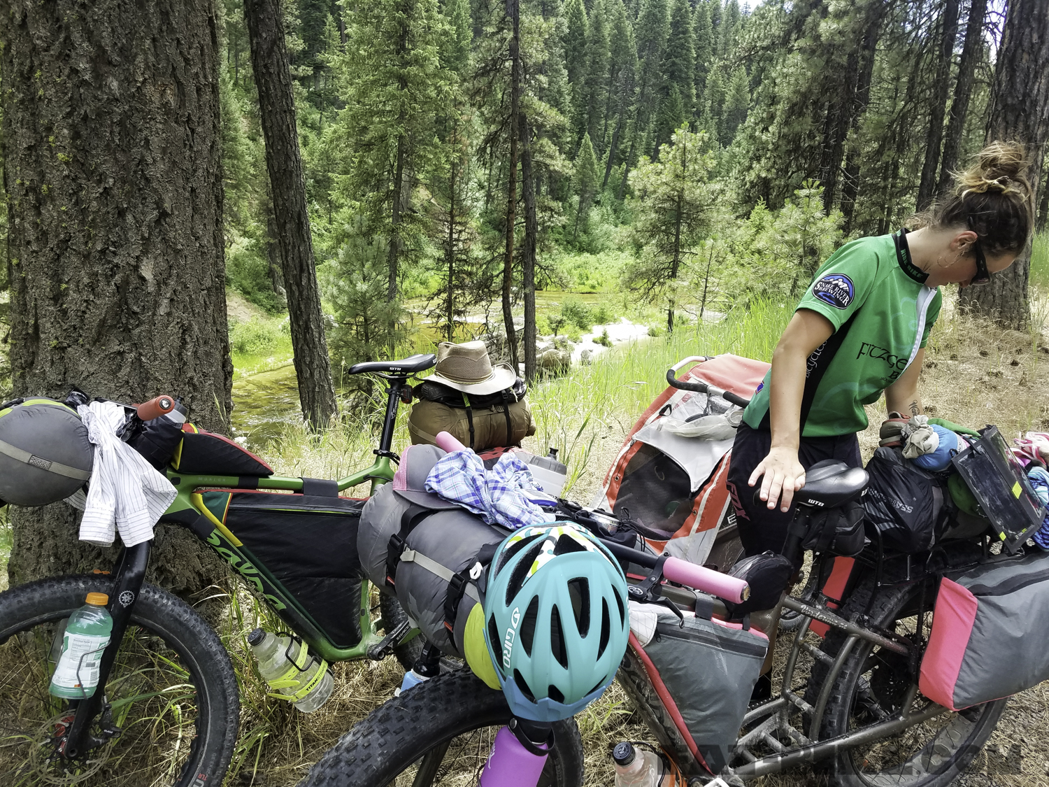
Each of our bikes and the Burley were carefully packed with our clothes, camping gear, cook kit, and food. Check out our detailed gear list (at the end of the article) for more information on the gear we used for this adventure.
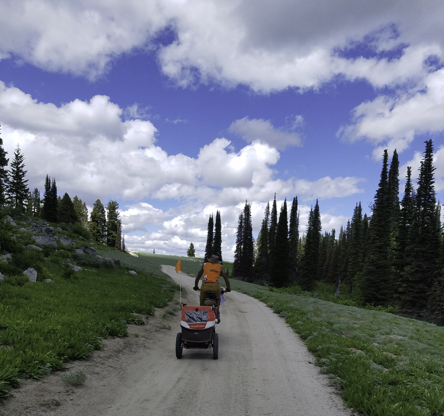
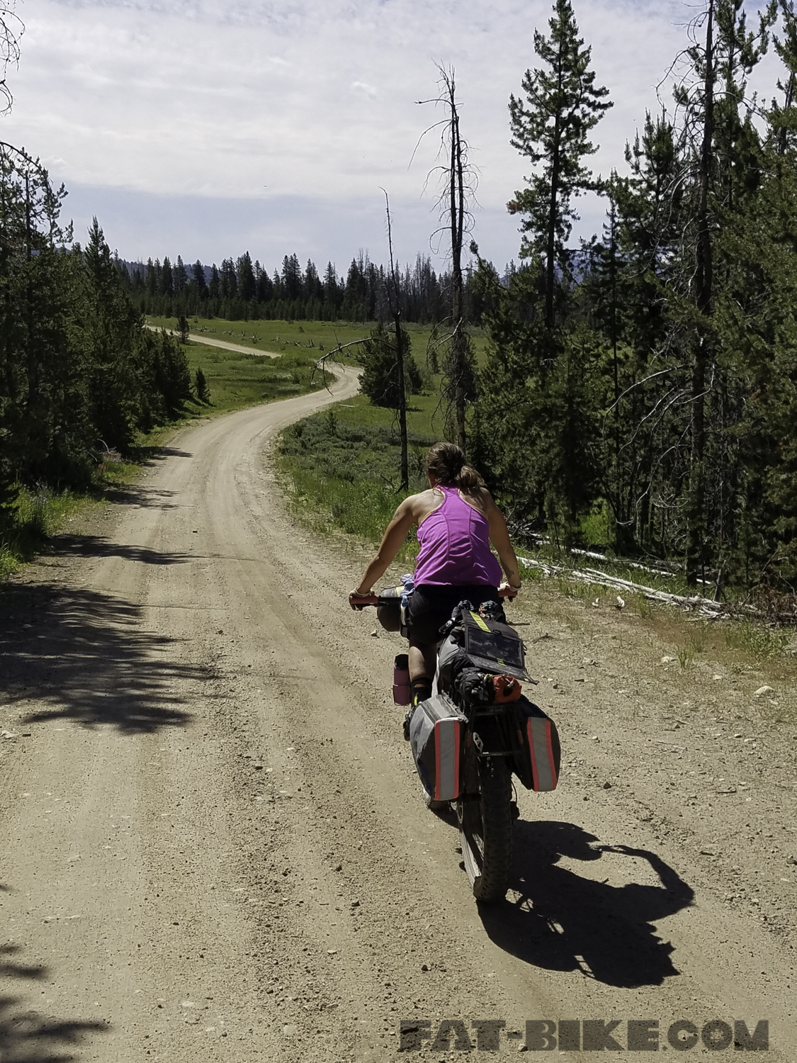
We began our ride with 12 miles of bike path from Hailey to Ketchum on June 16th. Once we were to Ketchum, we were officially on route. We had breakfast at The Kneadery and then we headed out on our way to tackle Dollarhide Summit. It is 25 miles from Ketchum to the Dollarhide Summit. We spent the majority of our day climbing to reach its summit. After reaching the top, we descended and stopped for the night at Five Points Campground. On our first day of riding we passed Frenchman’s and Worswick Hot Springs. Frenchman’s was flooded out by the river and Worswick was no warmer than a lukewarm bathtub, we decided not to soak.
Bryon climbing Dollarhide Summit, outside of Ketchum.
We ended our first day with just over 50 miles of riding and 3,600 feet of elevation gain.
Soaking in Preis Hot Springs
We started out our second day of riding with a soak in Preis Hot Springs. This hot spring was a little wooden box in the hillside just off the side of the road. It was refreshing to start our day this way. After departing Preis Hot Springs we headed toward Smoky Bar, a small store, where we ate ice cream. From there we continued on, before we were faced with a hurdle.
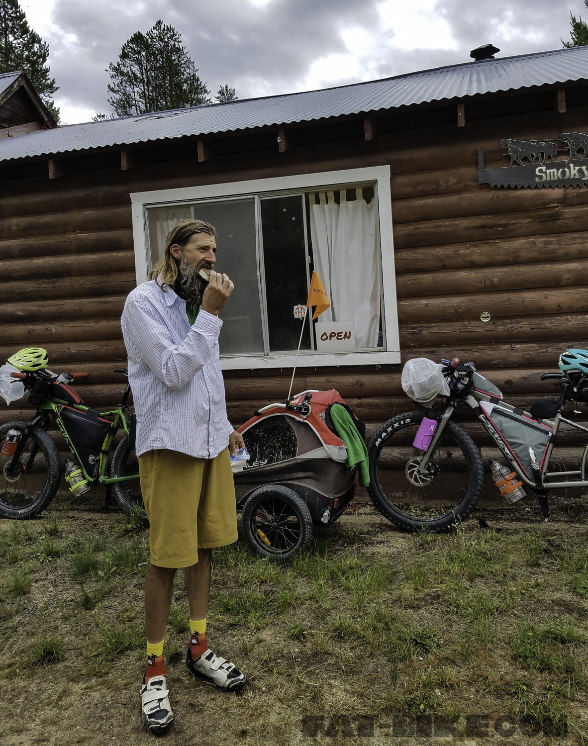
Eating ice cream outside Smoky Bar.
The road was washed out not far from Smoky Bar. It appeared there may have once been a path along the side of the washout, but it had since been worn away. We pondered how we would get across this overflow. We ultimately decided that with our loaded bikes and the Burley and April, it would be easier to reroute.
The washout after Smoky Bar that caused us to reroute.
We returned to Smoky Bar and a woman gave us basic directions to reroute. She also informed us that even if we had made it past the wash out there were numerous slides further along the route past the wash out. The beginning of our reroute took us back towards where we had camped the previous night, up and over Couch Summit, and then on to Fairfield.
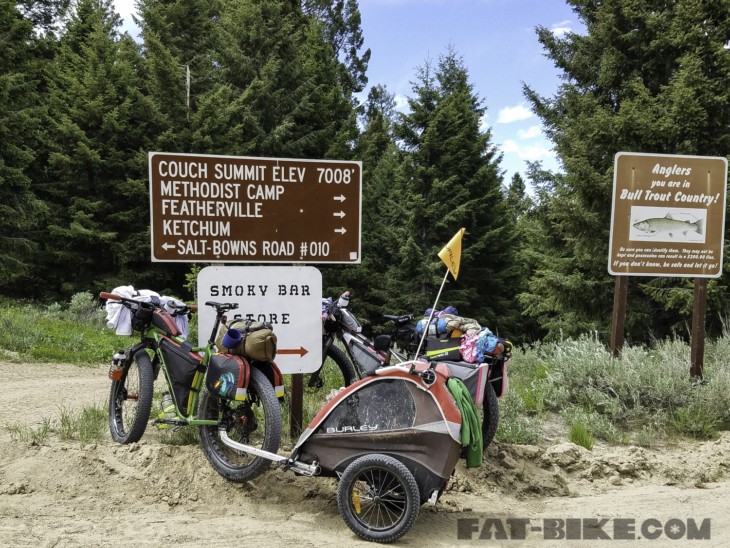
Rerouting, Couch Summit.
We climbed Couch Summit and were hit with pouring rain on the descent. We were unsure of our reroute past Fairfield, and with the poor weather decided to check into a motel, for the evening, dry out our gear from the previous night’s rain, and figure out the rest of the reroute to get to Featherville from Fairfield.

Coming into Fairfield
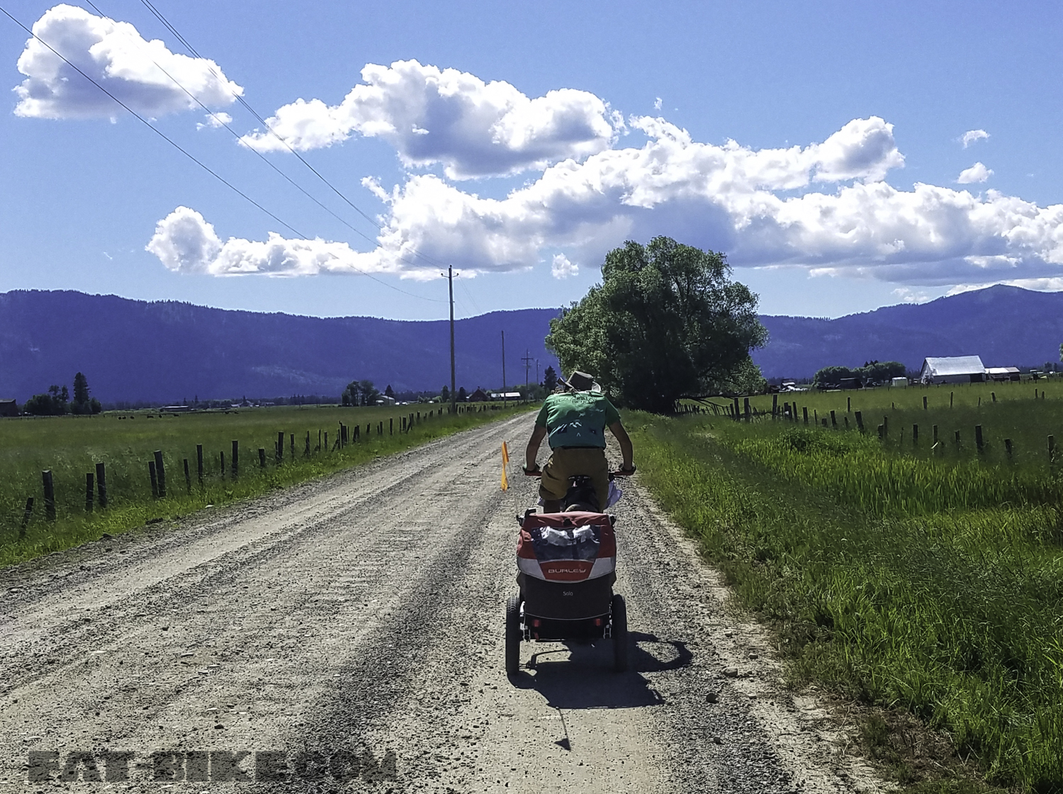
Our third morning we took off across the Idaho farmland headed for Pine and Featherville. The owners of The Prairie Inn had been especially helpful in helping us avoid the highway and reroute through local farmland until we joined up with the Pine-Featherville road that would take us back to the route at Featherville.

Riding across the farmland
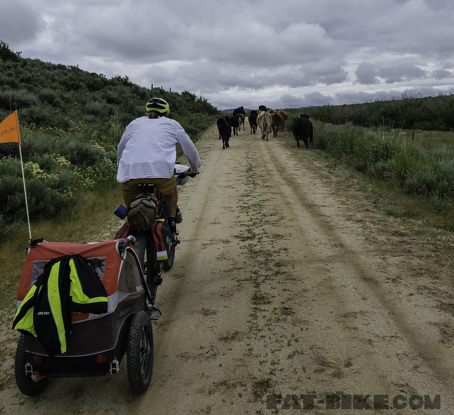
We eventually came to the Pine Reservoir, where we stopped for lunch, after a morning of chasing cattle.
We reached Featherville by dinner time, after once again riding in the rain for a couple of hours. We found Abbot Campground just outside of the town. It was in a beautiful ponderosa forest. A kind couple and their daughter, also staying at the campground, offered to help Bryon cut some firewood. April played in the pine needles, as we set up our camp for the night.
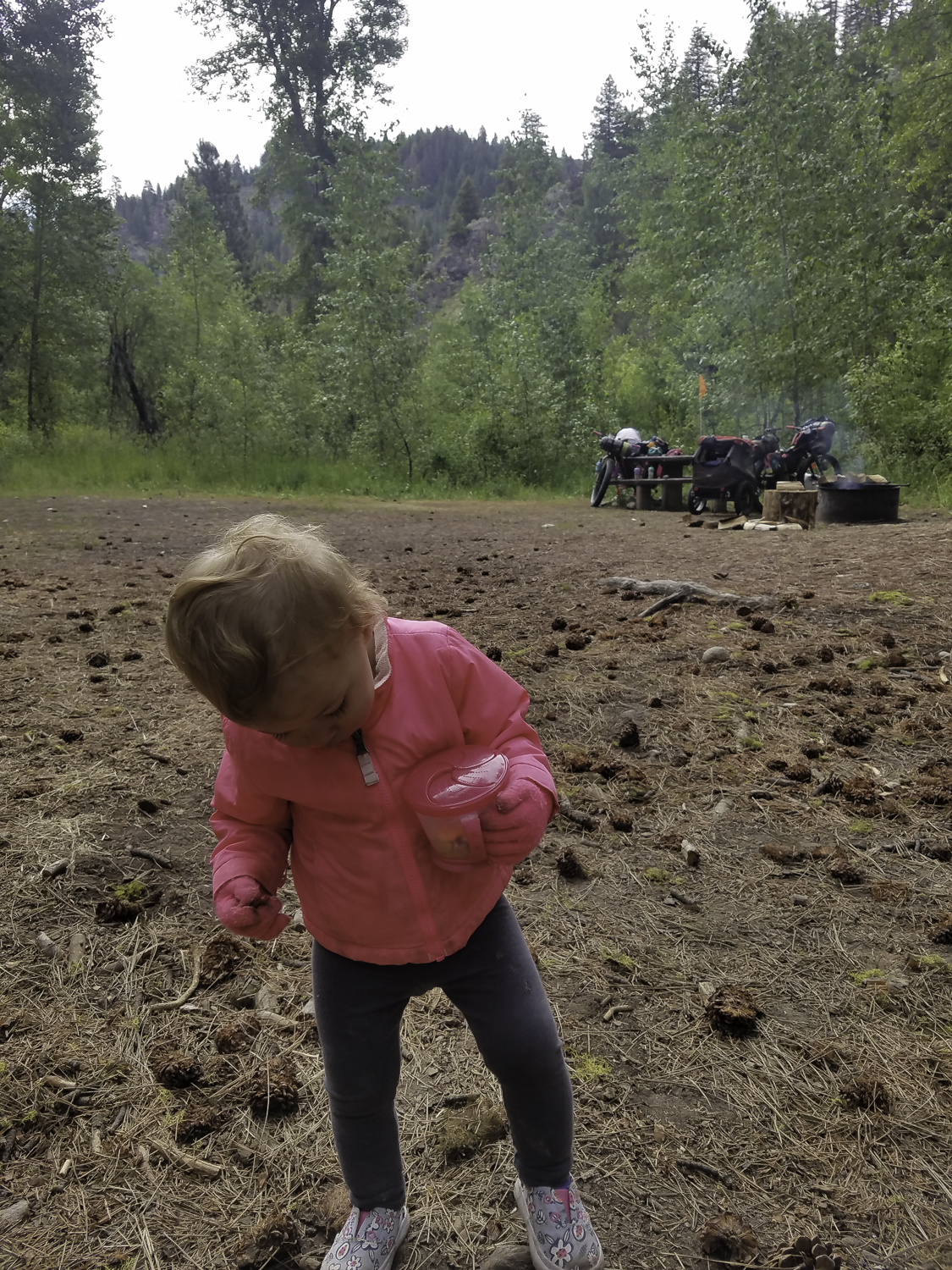
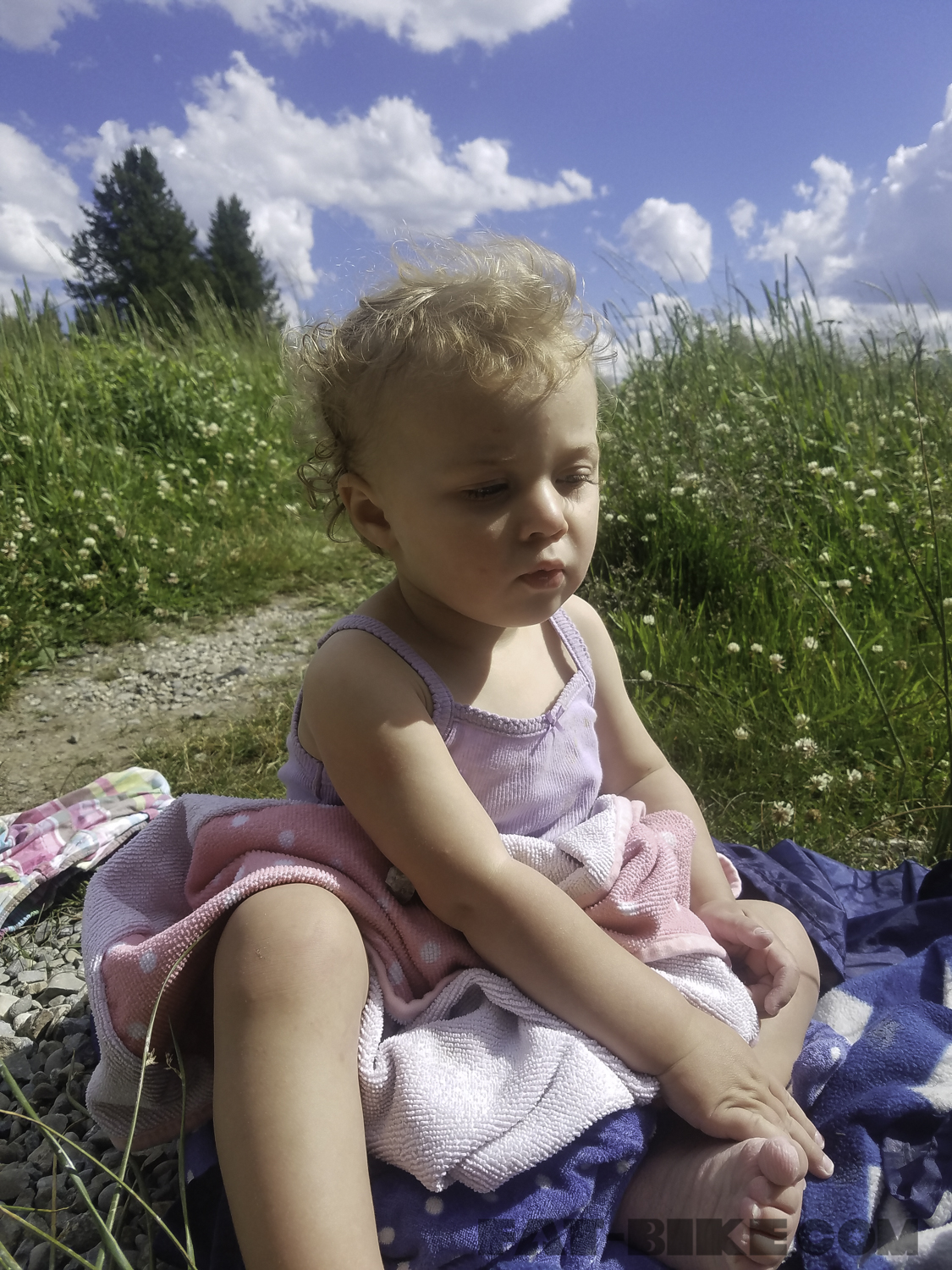
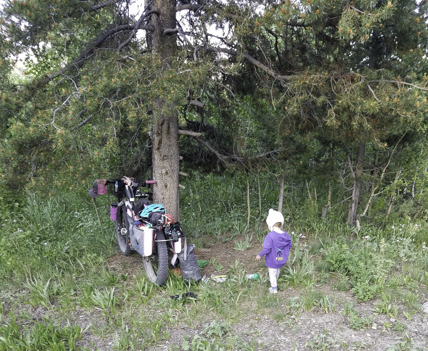
April at Abbot Campground near Featherville.
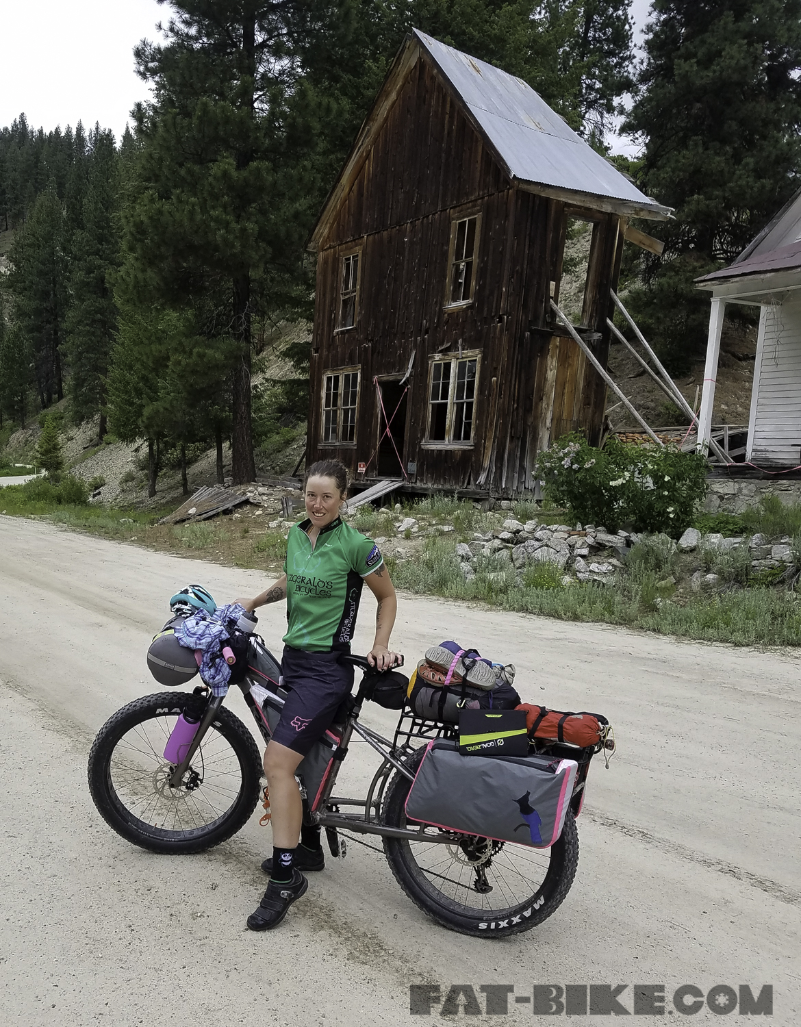
We filled our waters in Featherville before climbing to Rocky Bar, the next morning of our journey. Rocky Bar is a ghost town, that is now privately owned. Gold mining once flourished in the area. The region is full of tailing piles as one leaves Featherville and heads out to Rocky Bar.
The route climbed the first 16 miles of the day, through Rocky Bar and then up Steel Mountain, before descending to the Boise River. There were a number of hot springs ranging from a dilapidated shower shack to the trickling waterfalls of Loftus Hot Springs, on this section of the river. Many of the hotsprings were also on the opposite side of the river, during this part of our ride.
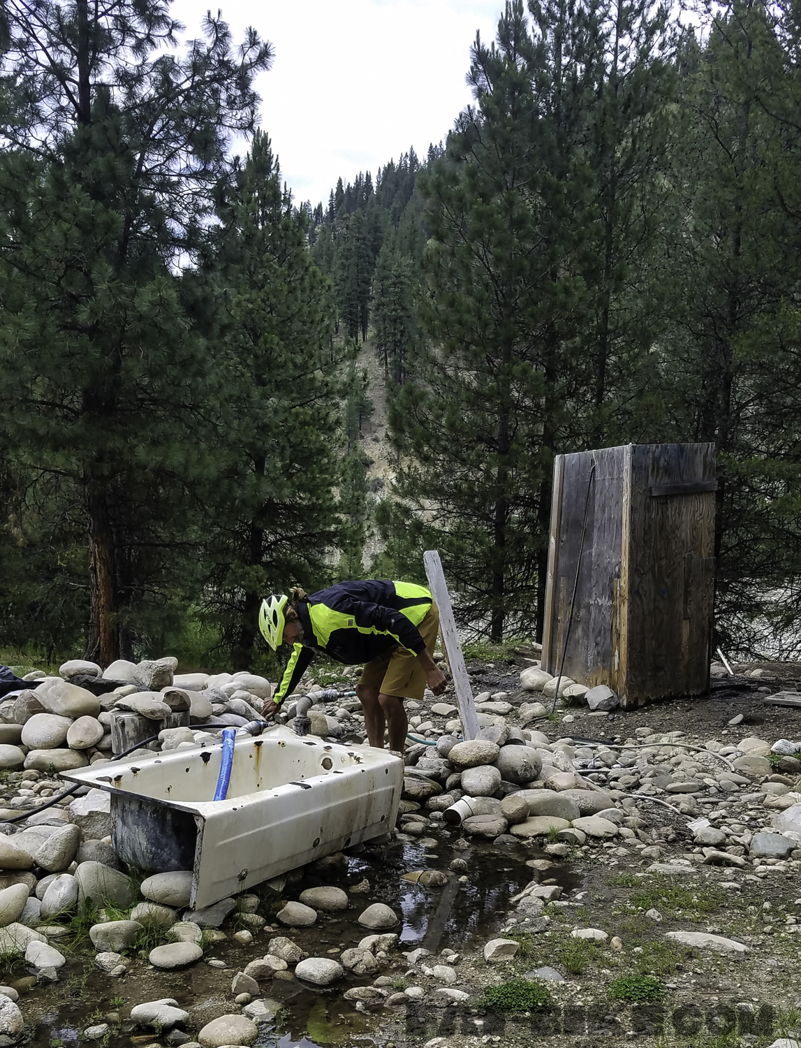
Loftus was our favorite hot spring on the route. It was a trickling waterfall, into a large pool on the opposite side of the river. We enjoyed our evening soak in Loftus before heading to Badger Creek Campground to cook dinner and set up camp for the night.
Badger Creek Campground was one of our favorites, of all of our campsites on this trip. It bordered the river and as we found often on our trip, if campgrounds did not have water or trash, they were free of charge. The majority of our nights were spent in campgrounds such as this. Water was accessible from the river and we filled our containers and used MSR water purifying tablets to ensure they were free of bacteria before we drank from them. We carry a steripen for water purification usually, but ours was not working, so we were fortunate to also have brought along MSR tabs on this trip.
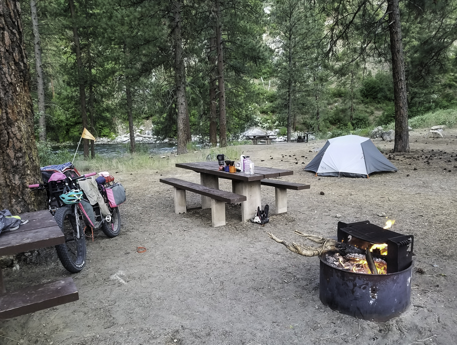
Badger Creek Campground
We departed Badger Creek Campground, on the morning of June 20th. This was our fifth day for riding and it was our toughest. In the 45 miles we travelled this day, we climbed over 5600 feet. The first portion of the day along the river continued to gradually descend. We came to a juncture in the road where one has the option to go Boise. Adventure Cycling included this portion of the route, as it goes to the Boise Airport, making this route accessible for anyone flying in to do it. We went right instead of taking the Boise Spur.
Riding along the river road, before our big climb.
Once we left the river we began to climb. We climbed for 16 miles to Thorn Creek Butte Lookout Tower. The climbing was steep and required Becky to push her Blackborow at times. The Bald Mountain Road led us to just over 7,000 feet. Then the saddle took us through a beautiful meadow.
Bald Mountain Road, near Idaho City.
From Bald Mountain we descended 15 miles to Idaho City. In Idaho City we indulged in greasy burgers and fries. We resupplied on food and diapers here. The townspeople were friendly. An old woman even gave April a toy hippo, as we loaded up our bags with food after shopping.

Idaho City was booming in the gold mining era, in 1864 it’s population was larger than Portland. Today less than 500 people reside in Idaho City and it is primarily a tourist attraction offering a look into the historic west.

Idaho City, ID
We departed Idaho City, and found a dispersed camping option just off the road five miles out of town. Our camp spot was not ideal, as it was near the road, but there were not many options for dispersed camping in the area just out of town. We were exhausted and ready for sleep. A thunderstorm hit in the night and we woke up to wet gear. We passed through New Centerville and Placerville before reaching Crouch, a fairly large town, at lunch time. We dried our tent at the park, as we cooked our lunch of chicken tacos, before continuing on our way. We hoped to reach Silver Creek Plunge Hot Springs by the end of our day.
As we left Crouch we headed into the Payette National Forest. It began to rain as we rode along the Middle Fork of the Payette. The rain fell for a while as we climbed Trail Creek Summit. The road was soft and challenged us at times, as we ascended.
We reached Silver Creek Campground at dinner time. We set up camp, cooked our dinner of eggs, rice, and tortillas, and then headed for the pool. Along the Idaho Hot Springs Route there are a few hot springs that are established. We missed one with our reroute, others require room reservations to use, or may be adult only. Silver Creek Plunge Hot Springs was family friendly and a large pool, with black inner tubes to float in. April brought her little yellow float in the pool, as we swam.
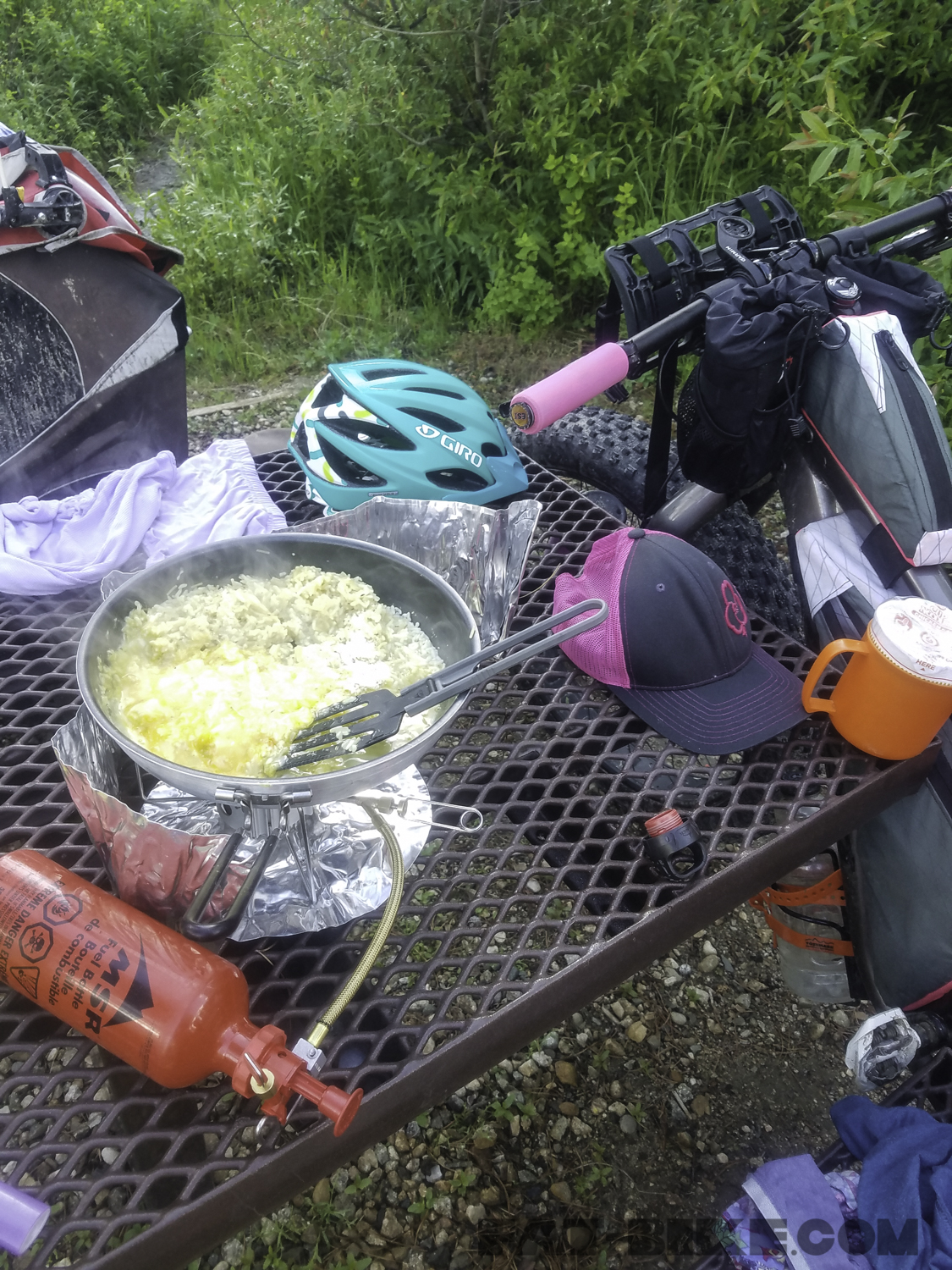
Cooking dinner on our MSR Dragonfly stove at Silver Creek Campground.
April slept in the next morning as we laid out gear and clothes to dry, loaded our bikes for the day, and enjoyed morning coffee.
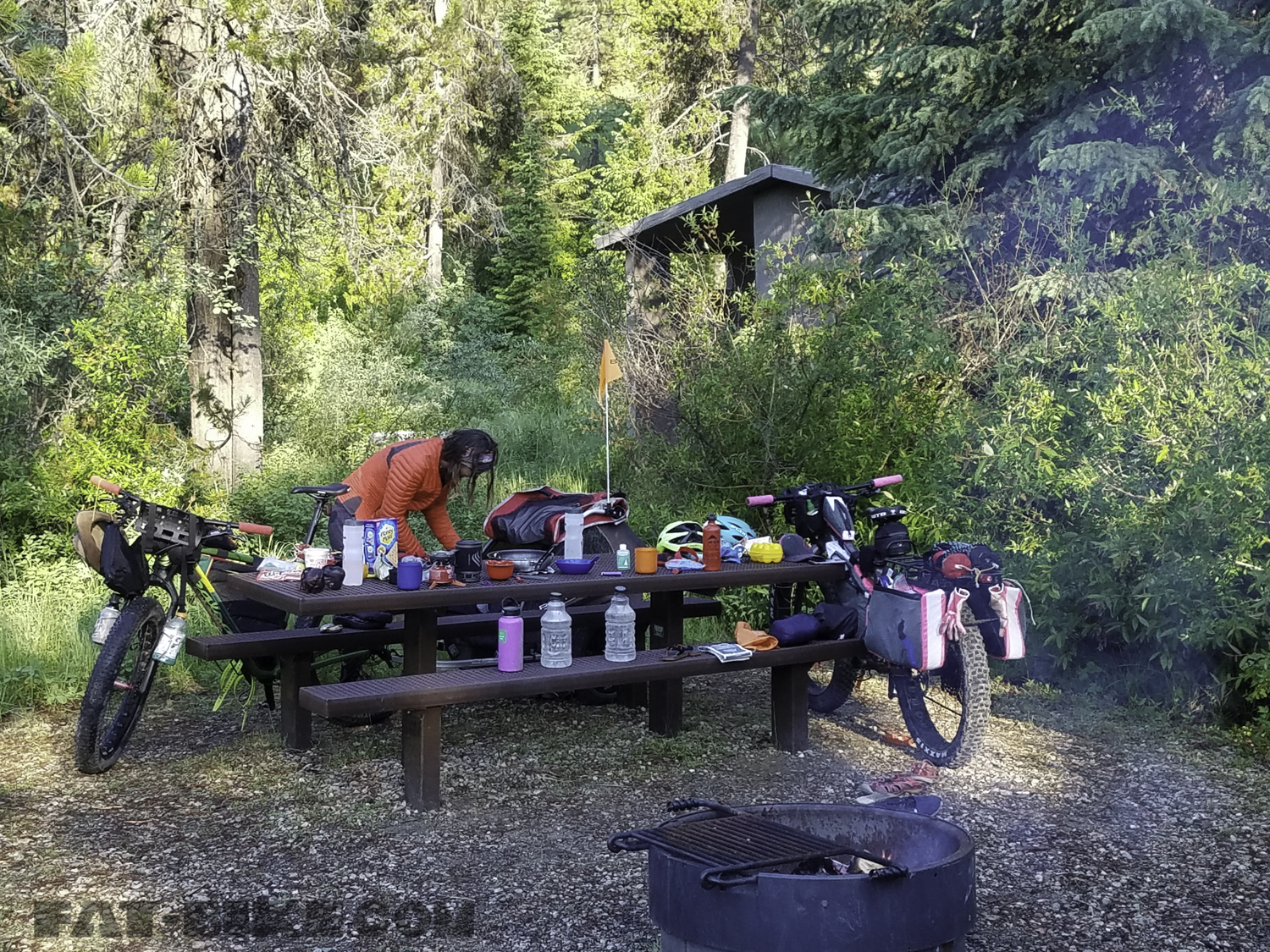
Morning at Silver Creek Campground.
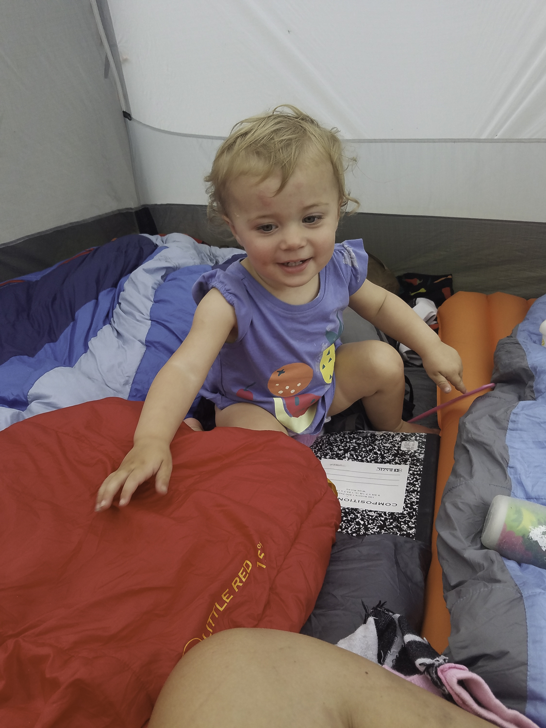
This is the second trip we have taken where April had her own Big Agnes Sleep System. We found she loved getting cozy in it and hiding from us in the morning, as we packed up. We strongly recommend the Little Red Big Agnes sleeping bag to any parents camping, with children.

April cozy in her Big Agnes sleep system.
We headed out from Silver Creek and climbed for a while before descending around 1500 feet back to the Middle Fork of the Payette River.

Before our climb out of Silver Creek
We then climbed from the river over the North Fork Range, where we rode along a ridge for quite some time before going back to lower elevations, where we camped at Clear Creek Station.

Riding from Silver Creek to Clear Creek Station.
Clear Creek Station was a RV park/campground, bar, and pizza joint. The pizza was not very good, but we enjoyed the calories after riding 40 miles and climbing 4000 feet on our seventh day of riding. As we ate dinner, we used the cellphone reception to book a room in McCall for the next night. We were 60 miles from McCall, where we would do laundry, resupply, and have a lazy day with minimal mileage.
Heading to our campsite at the Clear Creek Station.
In the morning, we rode through the fog from Clear Creek Station to Cascade. We arrived in Cascade and rode along Lake Cascade State Park, before coming to the actual town. Cascade appeared to be a summer getaway, with lots of people with RVs and boats.

Morning fog on the way to Cascade.
From Cascade we headed out to the mountains again. We climbed up the road that ran along Eagle Nest Mountain, topping out at 6,500 feet. We came across a pair of mountain bikers on the way up and then again at the top. They were intrigued by our set up and where we were headed. The road along Eagle Nest went on for about 5 miles before dropping down to Roseberry. Roseberry was a small town, now museum/ghost town, once settled by the Finnish.

We were 15 miles out of McCall at Roseberry. The road to McCall, Farm to Market Road, was paved, but with a brutal headwind, the last leg of our journey for the day was not easy. We pushed on across the farmland between Roseberry and McCall, stopping to take pictures of the European Fallow Deer, as we passed the Black Pine Deer Farm.
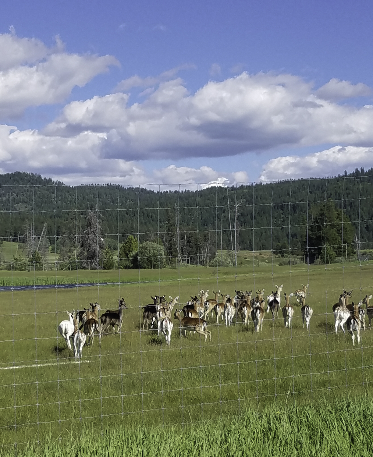
European Fallow Deer, Black Pine Deer Farm.
We were exhausted when we finally stopped at The Pancake House, in McCall, a family-style restaurant for a dinner of salads, burgers, and fries. We had ridden 60 miles, our longest day in terms of distance, on the trip.
Riding to McCall.
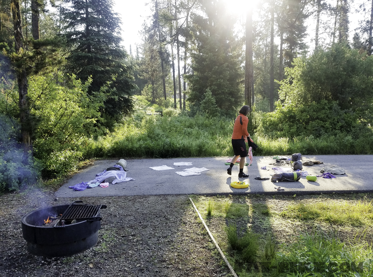
We checked into The Rustic Inn, after our dinner. We showered and spent the night in an affordable suite at the motel. We were across the street from the laundromat, so in the morning we did our laundry and repacked our bikes and charged garmins, and phones. Next we made our way to the local Albertson’s to restock our food and diapers. We had planned on shopping and then heading a few miles out of town to Lake Fork Campground, to rest the remainder of the day.

Resupply in McCall.
Lake Fork Campground, although full of mosquitoes offered a nice place to sit under the pines, and enjoy our natural surroundings, with a fire burning. We read, listened to the sounds of nature, and April played on her blanket most of the afternoon. Bryon cooked us steak on over the fire for dinner and we were nourished for the full days of riding that remained.
Lake Fork Campground.
From Lake Fork Campground we headed out over Lick Creek Summit, on the tenth day of our adventure. The road reached its summit in an awesome rocky terrain. The descent that followed was spectacular.
Lick Creek Summit.
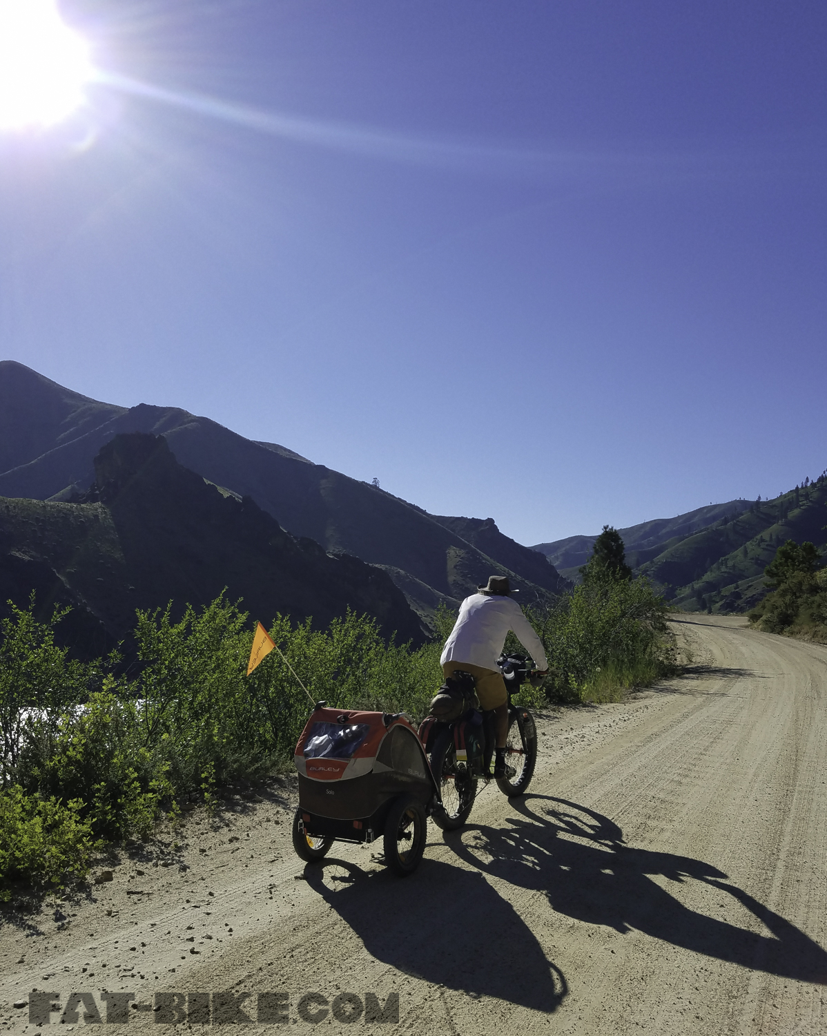
We passed a couple of hot springs after we descended Lick Creek to the South Fork of the Salmon River. They were down steep narrow paths, so we decided to pass on them as our bikes would be left unattended above and maneuvering down the trails would be difficult with April. The road was paved along this section and we followed this paved road for the next 30 miles. It was strange for us to find a paved forest road, just out there in the middle of the the national forest, after riding on dirt for so many days. We were miles from any town. We later found out that the road was paved to prevent sediment from running into the river.
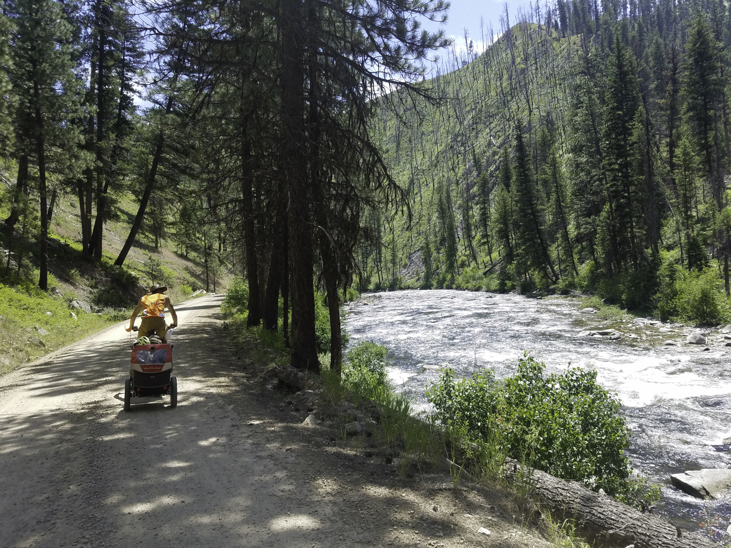
Riding along the South Fork of the Salmon River before it turned to pavement.
We camped at Poverty Flats for the evening. The Forest Service frequented the campground, monitoring the salmon fisherman. They stopped to talk to us briefly as we set up camp, asking if we had been fishing at all. The mosquitoes were thick at Poverty Flats, so we headed into our tent early.
Camping at Poverty Flats on the South Fork of the Salmon River.
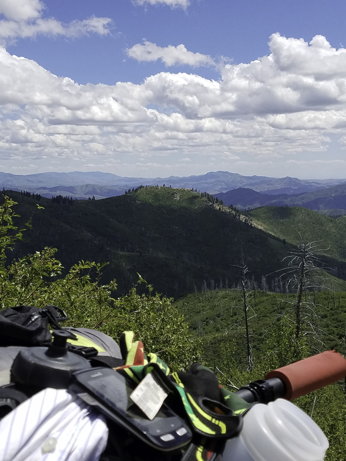
We left Poverty Flats and then climbed to Poverty Summit, in the morning. From Poverty Summit we climbed steadily to North Shore Lodge at Warm Lake. We ate greasy burgers and stocked up on snacks, before heading up the road to Warm Lake Summit. We would recommend using North Shore Lodge as a resupply for snacks, we would however not recommend the eating of the burgers. The climb up Warm Lake Summit was hot and difficult. They were chip sealing the ascent as we made our way up. A woman from the construction company asked if we were committed to riding the section, where the flagger and pilot car were, or if we would like a ride up in her truck. We chose to pedal. On our ride up the mountain one of the workers gave us bottles of cold water, and at the top of the summit, the woman who had offered us a ride, topped off our waters too. We were very thankful for the water. Water was plentiful on our course, but cold water, that did not taste of the purification tablets was a treat.
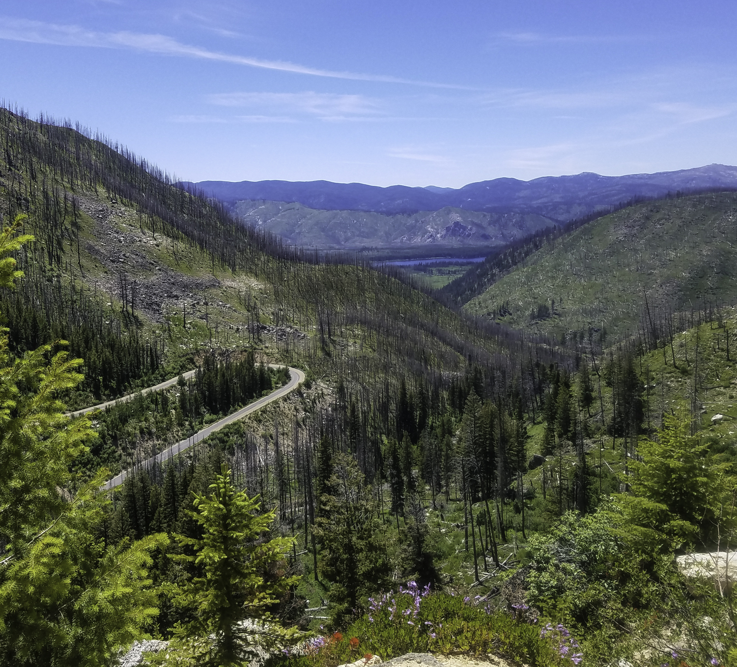
The view from Warm Lake Summit.
We camped at Penn Basin Campground, just a few miles down the other side of Warm Lake Summit. Pen Basin Campground was right on a creek, so once again we were provided with fresh water. The mosquitoes were not as thick on this side of the mountain.

April watching the trucks working on chip sealing Warm Creek Summit.
We thought we heard animals the night we camped at Penn Basin. We were up at 2 a.m. hollering and blowing our whistles, fearing bears might be trying to take down our food bags. Most nights we hung our food up in our dry bags in a tree outside of our campsite, to prevent animals from getting into them. In the morning at Penn Basin we found deer tracks, and no animal had gotten into our food supply.
April at Penn Basin Campground.
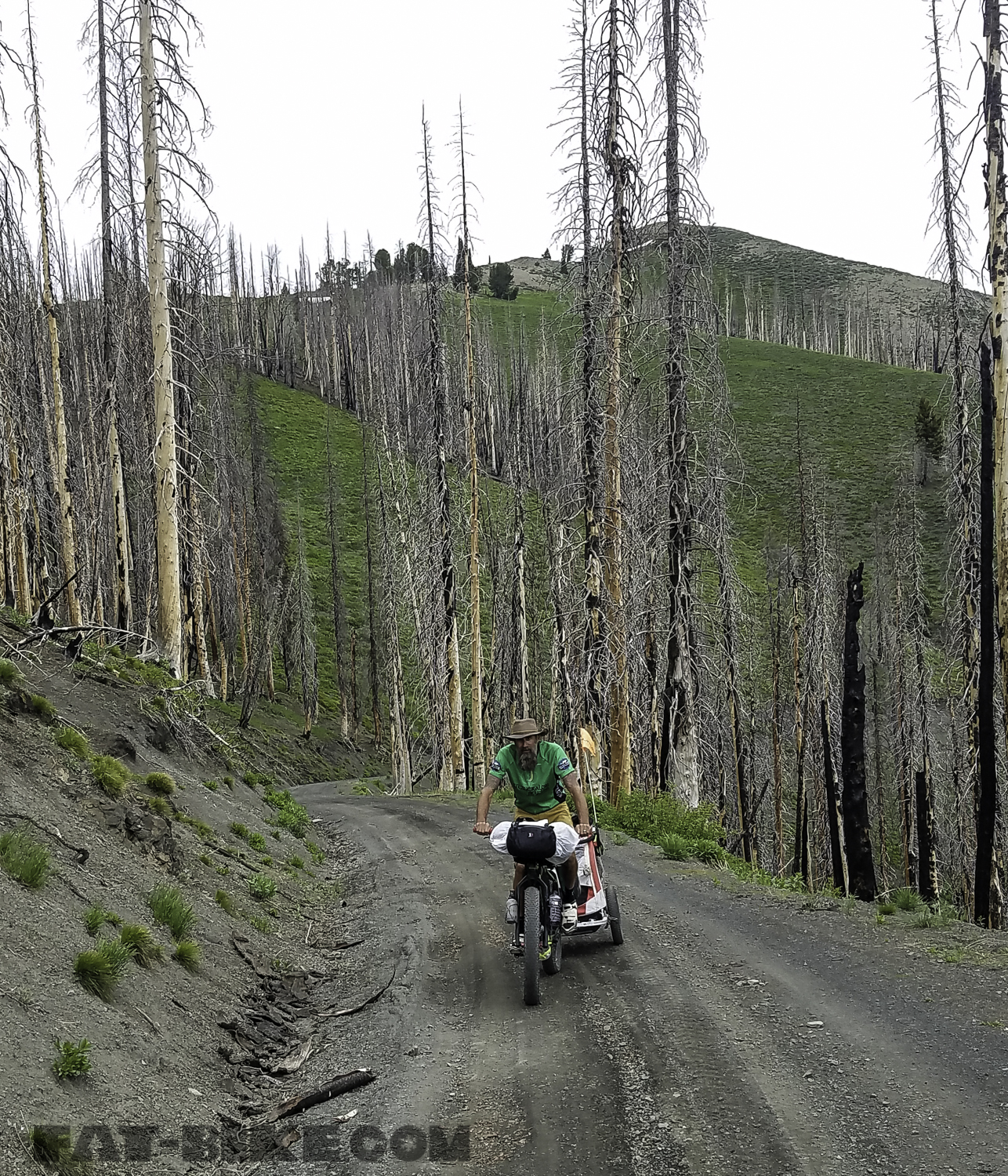
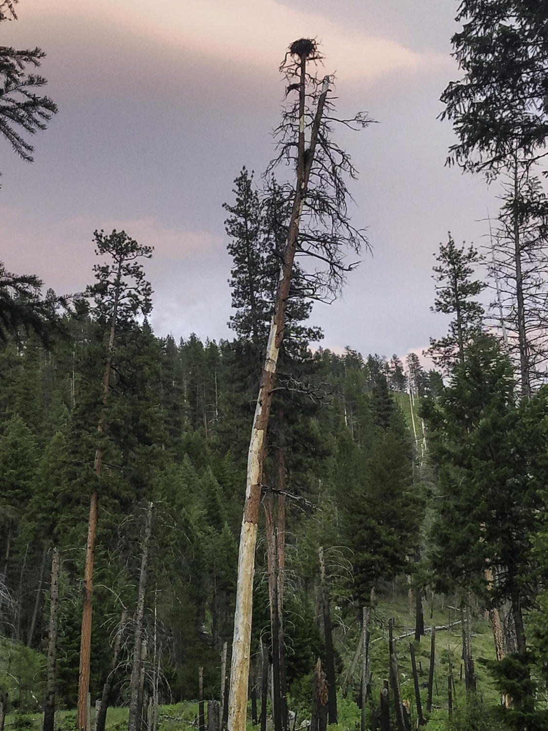
From Penn Basin Campground we travelled to Deadwood Summit and then over Deer Creek Pass. We found Deer Creek Pass to be very eery at times. Many of the forest roads we travelled took us through areas previously burned by forest fire. The Deer Creek Pass area had burned more recently than the others. The trees were charred and one can smell the char, as they ride through the forest. A caravan of trucks carrying kayaks stopped in this section of our route and offered Bryon a beer, just as we were stopping for lunch. They asked about April, and waved at her before taking off again.

Deer Creek Pass.
After riding along Deer Creek Pass, we decided to stop and camp at Fir Creek Campground. We would climb Cape Horn Summit and go into Stanley the next day. Fir Creek Campground was another one of our favorite campgrounds. We were the only ones at the campground besides the tribal forest service, that had set up a fish trap to count the Chinook Salmon. We were right next to the creek and someone had made a pool out of rocks that we were able to stand in to clean both ourselves and our clothes. There was also a wooden fence at the camp that made it easy to air out and dry our gear. The campground had a number of chipmunks though, and we soon found they wanted our food, after they ate into a bag of peanuts we had sitting out.

Cleaning up in the water.
We climbed Cape Horn the thirteenth morning of our Idaho Hot Springs Route Tour. We had mac and cheese for lunch in the forest, before diverting to Hwy 21 in the afternoon to take us to Stanley. We chose to take the highway the last miles to Stanley when we came to a creek crossing that was deep enough that we could not just ride across it with the Burley.
Somewhere between Cape Horn Summit and Stanley.
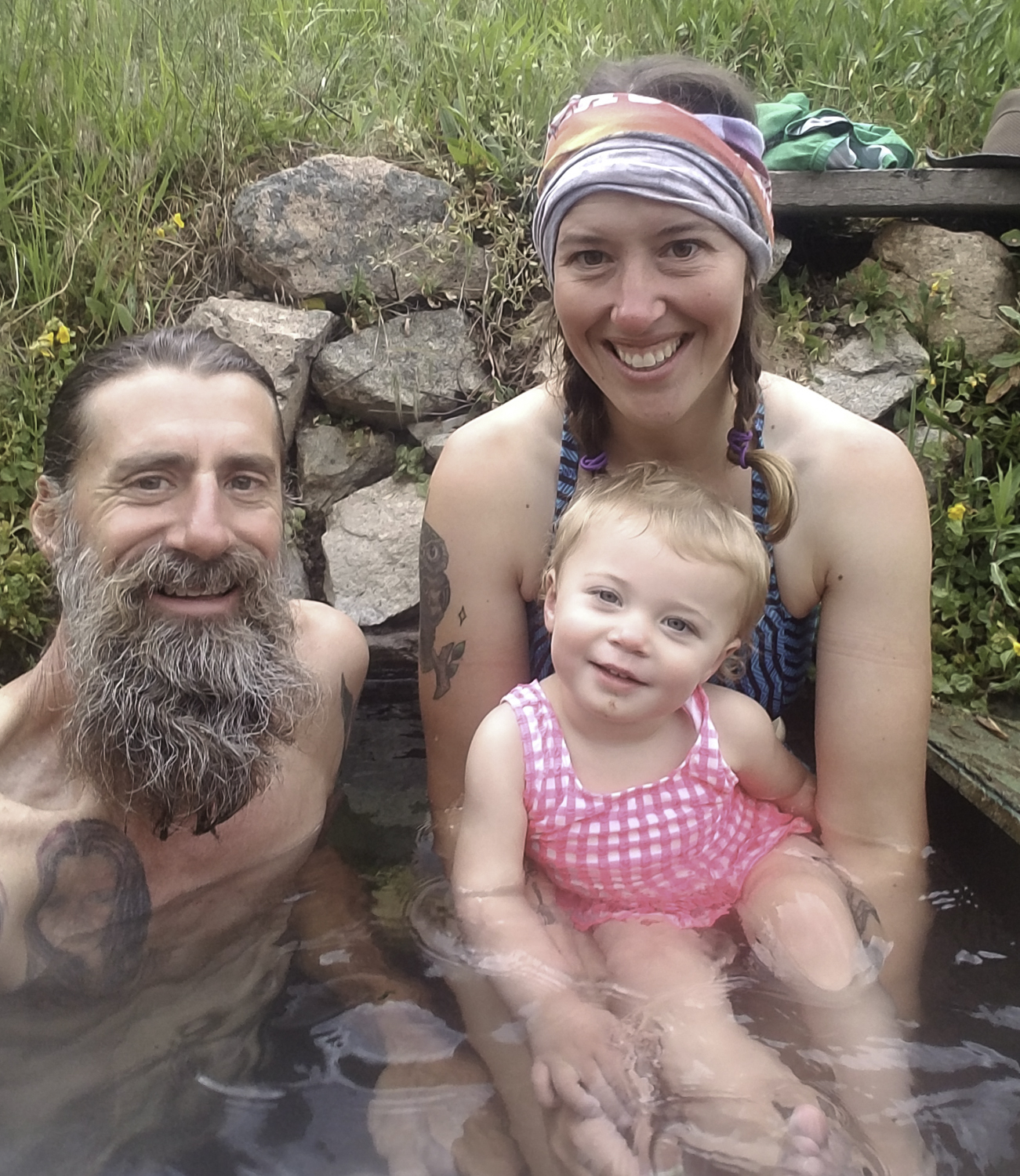
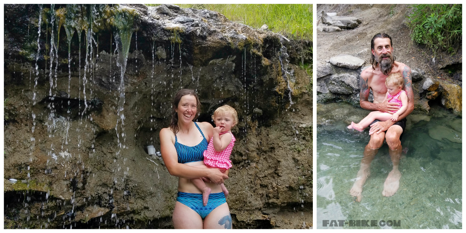
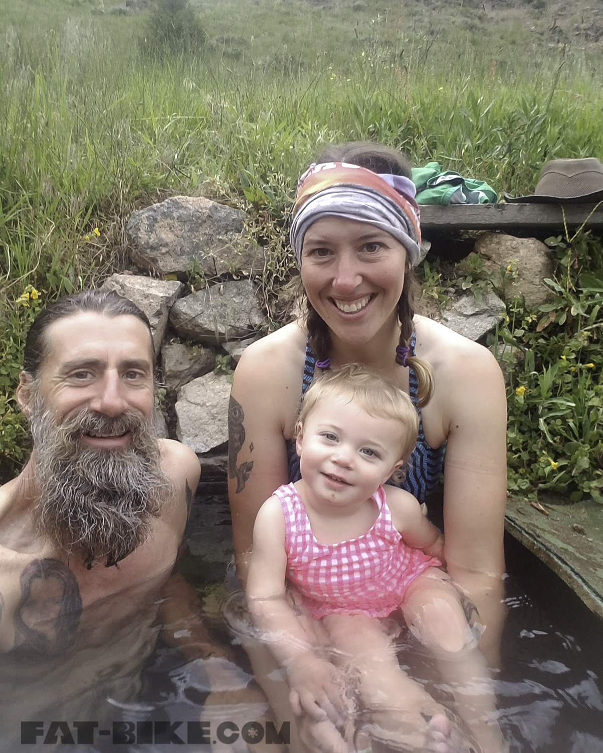
We arrived in Stanley and made reservations to soak in the hot spring at Mountain Village Resort. This is small hot spring in a cabin on the resort property. For $27 we were all able to soak for an hour. We had an hour to kill before we soaked, so we took care of our shopping. We had two days left, so just needed a few things from the market. We also went to the outdoor store to get fuel.

Mountain Village Hot Spring in Stanley.
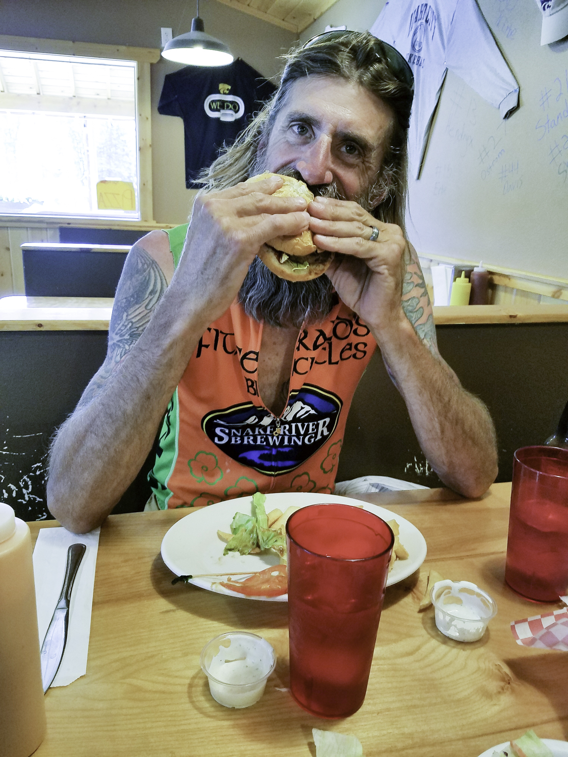
We enjoyed our soak in the hot spring. Four rafters, preparing for a thirty day raft trip, also had reservations during our soak time and we enjoyed talking with them about our journey and their trip they were preparing to depart on. April kicked her feet in the water and we all felt refreshed before heading to Mountain Village Restaurant for burgers. We camped 3 miles out of Stanley after dinner and having to go to Lower Stanley for diapers. Diapers of all sizes were not available in Stanley, fortunately the small market in Lower Stanley sold April’s size individually.
April after our soak in Stanley.
Sunny Gulch Campground was rather large, and we were able to obtain one of the few sites left for the night. We pitched our tent, we had our last big climb ahead the next day…Galena Summit.
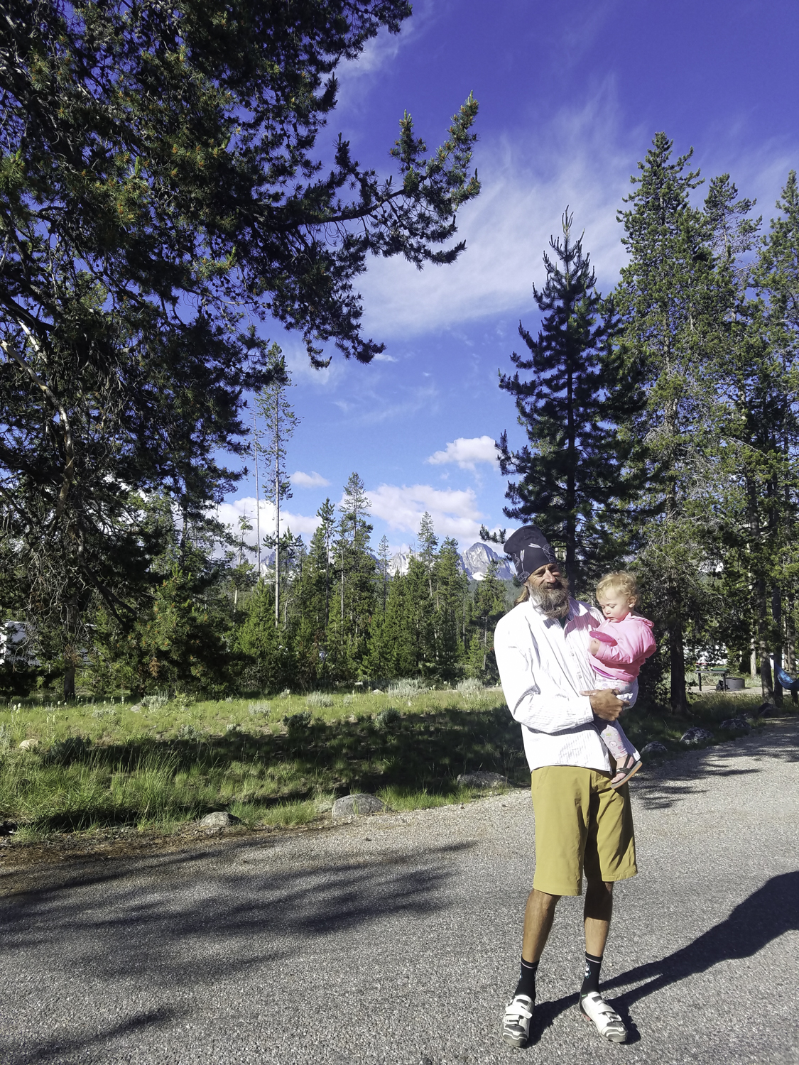
April and Bryon at Sunny Gulch Campground.
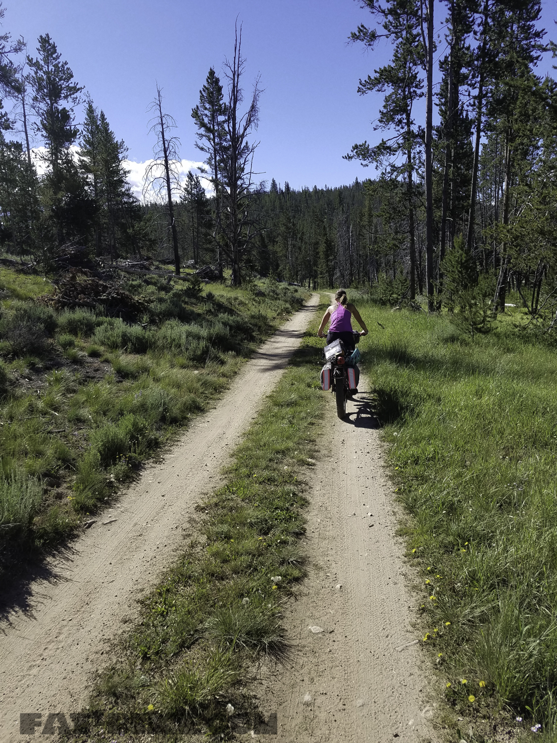
We left Sunny Gulch Campground and rode along a serene double track in the forest, the second to last morning of our journey.
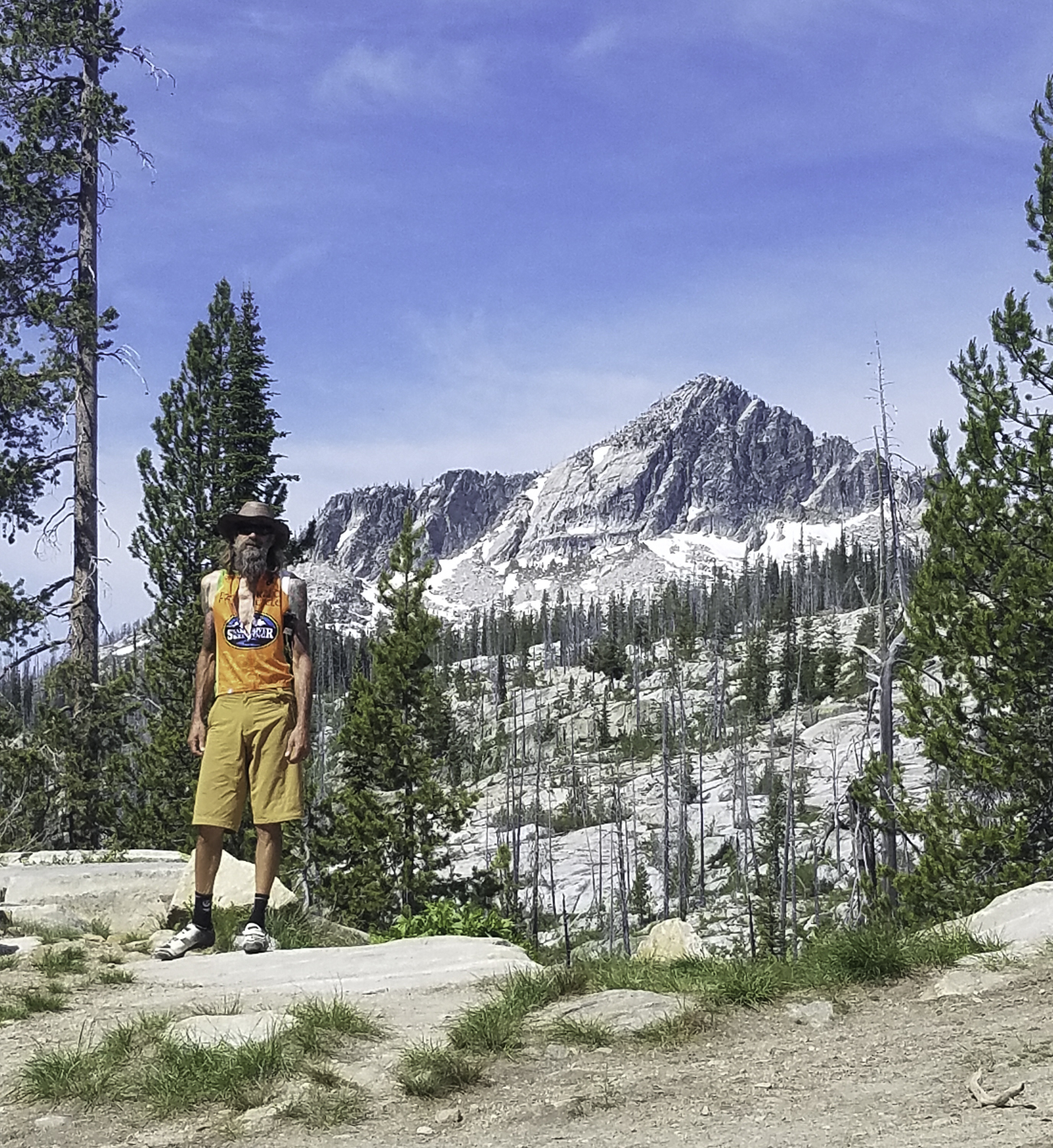
Eventually, the road turned to rocky gravel. We slowly navigated our way through the open sage fields taking in the view of the Sawtooth Mountains. We ate lunch in the sage before we came to the highway again.
Riding with the Sawtooths in view.
We then took the highway up to the top of Galena Summit. On our fourteenth day of riding we were to the point of exhaustion, but each pedal stroke brought us one bit closer to our finish.

We reached Galena Summit before dinner. We descended to Galena Lodge, hoping to get a bite to eat, but they had closed at 4 pm. We had beans and chicken for tacos in our panniers, so headed down to the Russian John Hot Spring from Galena Lodge, via the Harriman Trail to eat. We found the Harriman trail very loose as it is a trail of pea gravel. We reached Russian John Hot Springs just around 6 pm. There were others swimming in the pool, and they asked where we had come from. They warned us the hot spring was no warmer than bathwater, and after sticking our hands in we decided not to soak. As the other group departed, we began to make our dinner, before heading up the road to find a place to camp for the night. We were familiar with the area at this point, as we had camped nearby for Rebecca’s Private Idaho, last fall.
We cooked dinner and then moved a couple miles down the road to Silver Creek. There was a parking area with dispersed camping off of it, at Silver Creek. We discussed our plans for the next morning, our last day of riding, as we set up camp one last time. We decided we would rise early, pack up, and power back to Ketchum in time for breakfast at The Kneadery. We hit 600 miles on the way back to Ketchum for breakfast our last morning. We enjoyed a large hearty meal at the Kneadery, and then made our way along the bike path from Ketchum to Hailey.
Our Idaho Hot Springs Route ended with a total of 622.8 miles and 42,162 feet of elevation gain. The route took us 15 days to complete and we camped twelve of our fourteen nights. We enjoyed spending time together, as a family. We were fascinated by the beauty we found in the state of Idaho. We were so proud of April, and loved sharing this experience with her. We hope to do it counter-clockwise next time, otherwise we wouldn’t change a thing. We were pleased with our bikes, bags, gear, and how our bodies performed.

We would like to thank Fitzgerald’s Bicycles for helping us prepare our bikes and Bryon’s last minute repair, for this journey. Burley Design provided us with the Burley Solo and plus wheel set. Thank you, Burley! We are in awe with the capabilities of their trailers, as we take April along on these adventures. Also big thanks to Fat-Bike.com, Big Agnes, and Honey Stinger for their continued support.
We will be heading to Alaska next month, for our next adventure. Until then we look forward to some time at home, exploring our surroundings, with April Jean in tow.
Idaho Hot Springs Tour Gear List
Shared Gear:
Family Cook kit:
MSR Dragonfly stove
1 16 oz Jetboil
1- 20 oz MSR fuel canister filled with white fuel. We topped this off in Stanley.
2 small canisters of MSR IsoPro Canister Fuel
1-10-inch GSR camp skillet
1-8 oz saucepan- handle has been modified
MSR cook kit that includes spoon, spatula, cutting board, salt and pepper shaker
Extras MSR spice container with garlic salt and lowry’s.
Knife
Small plastic bottle for cooking oil
2 GSR camp coffee filters
2 Coghlan’s Egg Holders
Campsuds concentrated soap
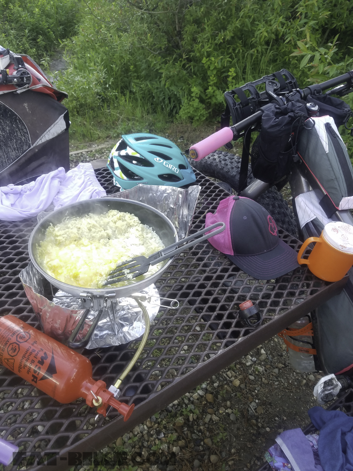
We used our MSR Dragonfly for almost all of our cooking. The 16 oz Jetboil was used to boil water for coffee, the rare freeze-dried meal, and oatmeal.
Power and recharge station:
Goal Zero Nomad 7 Solar Panel
Venture 30 Recharger
Goal Zero Flip 20 Recharger
Camp Comfort:
Tent: Big Agnes Copper Spur HV UL3 mtnGLO tent, rainfly, and footprint
Chairs: 2 Mayfly Camp Chairs

Becky’s Setup:
Bike: 2018 Salsa Blackborow GX Eagle
Bags:
2 Revelate Mountain Feedbags
1 FBJ Creations Fuel Tank
2 FBJ Creations Custom Panniers “Suitcases”
1 FBJ Creations Custom Frame bag
1 Sea to Summit 14 L Dry Compression Bag
1 15 L OR Dry Compression Bag
1 Revelate Jerry Can (This is where we stored tools.)
1 Small Bontrager Seat Pack (We stored a spare tube here)
*Becky carried the tent, rainfly, and tent footprint in the OR compression sack, along with her sleeping bag, on the Salsa Anything Cradle.
*Food and small toiletries were stored in Revelate Designs Mountain Feedbags.
*Becky carried milk for a day after resupplies in the Hydroflask on her fork. As we were in bear country, both Byron and Becky carried bear spray and whistles on this trip.
*Becky’s custom framebag held an MSR bladder (which we never had to use as water was plentiful on this trip), her headlamp, and lots of food.
Cages and Cradles
1 Salsa Nickless Cage, stretched to fit a 32 oz Hydroflask
1 Anything Cage with 2 Voile Straps for holding 2 Liters of Water
1 Water bottle cage for bear spray
1 Anything Cradle
Rack
The Salsa Blackborow comes standard with a rear rack.
Becky carried our two camp chairs, 1 Sea to Summit Compression
Sack with both her clothes and April’s clothes, shoes, and the solar kit on top of her rack.
Becky’s Clothes:
1 pair shorts
1 pair leggings
1 t-shirt
1 light weight dress
2 pair extra socks
1 pair underwear.
1 extra chamois
1 extra riding top
1 pair of sleeves
1 White Sierra raincoat
1 pair Gore rain pants
1 puffy jacket
1 swimsuit
2 buffs
1 camping towel
Keen hiking Sandals
Toms shoes
*The Goal Zero Nomad 7 and rechargers clipped on top of Becky’s gear,
this allowed the rechargers to have the necessary power to charge
Garmins each evening and phones, as needed.
*The “Suitcase” Panniers, sewn by Bryon, stored our MSR stove, 20 oz fuel bottle, and a small 4 season universal fuel. We also stored our skillet, saucepan, pump, April and Becky’s sleeping pads, binoculars, and lots and lots of food in the “Suitcases.”
Becky’s Sleep System:
Big Agnes Air Core Ultra Sleeping Pad
North Face Cat’s Meow Sleeping bag
Bryon’s Setup:
Bryon’s bike, Puff Muk, Fat and Loaded.
Bike: 2017 Salsa Mukluk Carbon X1
Bags:
2 Revelate Mountain Feedbags
1 FBJ Creations Fuel Tank
2 FBJ Creations Custom Mini Panniers
1 FBJ Creations Custom Frame bag
2 15 L OR Dry Compression Bags
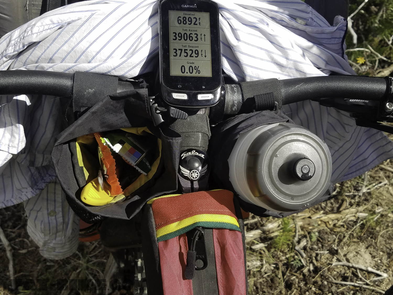
Bryon stored a water bottle and food for fuel in his Revelate Mountain Feedbags. He ran the Garmin Edge 1000 for the duration of our trip.
Cages and Cradles
1 Anything Cage with 2 Titan Straps for holding 2 Liters of Water
2 Water bottle cages, 1 for bear spray, 1 for powerade
1 Anything Cradle
Rack
Salsa Alternator Rack
*Bryon carried the Jetboil, a book, our handgun (for bear protection), bag of coffee and food in his custom mini-panniers.
*Bryon carried tent poles, sleeping pad, headlamp, steripen and more food in his framebag.
*Bryon carried his clothes and rain gear in the 15L OR compression sack on his rack. He strapped his water shoes and mug to his bag.
*Bryon towed April’s Burley Solo for the duration of our trip.
Bryon’s Clothes
1 pair shorts
1 pair Craft pants
1 t-shirt
1 tank top
1 underwear
1 pair extra socks
1 extra chamois
1 extra jersey
Sleeves
1 puffy coat
1 Gore raincoat and pants
2 buffs
Swim trunks
Water shoes
Sanuk shoes
Small towel
*Bryon carried April’s and his own sleeping bags in the 15L OR compression sack, on the Salsa Anything Cradle, at the front of his bike.
Bryon’s Sleep System:
Big Agnes Q Core SLX sleeping pad
Big Agnes Lost Ranger sleeping bag
Awesome! Thank you for an amazing ride report. The actual ride sounds awesome, and for me, enhanced with the minute details about your gear, and how it fits within the constrains of your bikes, tells the complete story. Along with the gorgeous pictures, just awesome!
Thank you for sharing, anxiously awaiting to hear about your Alaskan travels.
PS – Those bags are sweet looking, form and function!
Sounds like an amazing trip! I was just talking about this trip to my dad and brother, as I live in the Boise area. Sounds like a blast!
Excellent all the way around, thank you
excellent documentation and even more amazing to do it with your young daughter